|

Garmin G1000 Updates

You have just received the keys of your shiny new (to you) airplane complete with a beautiful Garmin G1000 glass panel flight deck. Synthetic Vision, WAAS, and ADS-B are all installed. You are ready to cruise in high technology.

You turn on the PFD and MFD and notice one problem. All your databases are expired. No big deal, right? Your Garmin 530W was easy as pie to update with it’s single data card.

You start looking around and can’t find the data card. Then you notice that there are several SD cards in slots on the panels. SD cards won’t fit in your Blue Jepp Skybound card reader. Confusion sets in which quickly leads to full on panic.

What have you gotten yourself into?!

No need to fear, Texas Top Aviation is here to help with your Garmin G1000 database update confusion (and hopefully not panic).

Database Update Providers

First, you have to choose who to get your Garmin G1000 updates from. You have two options. One is Garmin (fly.garmin.com; always use either Firefox or Chrome to update, don’t use Safari). The other is Jeppesen.

Honestly, there is no difference between the data that each provides. If you had a 530 or 430 before, you used Jepp already. Just keep the Jepp account, call them, and have them get you set up for your Garmin G1000 updates.

If you didn’t have a Jepp account before, I would use Garmin, for a couple of reasons. You get multiple downloads in case you mess something up (Jepp NavData gives 1 download per month, while Safe Taxi, etc. you get 2-3). On Jepp, you have to call in and have them reset the account, which can be a pain if it’s after hours or a Saturday or Sunday.

The other problem with Jepp is since Boeing bought Jeppesen, I have found it extremely difficult to find online where to set up a new account and purchase databases. Yes, you can always call, but, again, problematic after hours or on a weekend.

The only problem with Fly Garmin for your Garmin G1000 updates is Garmin is constantly updating their program. You have to update their downloader quite often, which can be a bit frustrating.

I’m going to use Fly Garmin as my example.

What to Buy

Garmin gives you a couple of different bundle options for your Garmin G1000 updates, the OnePak and the PilotPak. The main difference between the two is the PilotPak includes approach charts that display on your PFD and the OnePak doesn’t. Therefore, the OnePak is about $200 cheaper.

Both include Navigation Data, SafeTaxi, Obstacles, Airport Directory, Terrain, and the BaseMap.

How to Update

Once you have followed all the instructions on Garmin’s website (or gotten Jeppesen set up), here is what to put on which SD card.

NOTE: YOU WILL NEED TO PURCHASE ONE OR TWO BLANK SD CARDS FOR THE NAVIGATION DATABASES. DO NOT PUT THE NAVIGATION DATA ON THE SD CARD THAT IS ALREADY IN THE TOP SLOT ON THE MFD. THAT IS FOR ENGINE DATA LOGGING ONLY. NO NAVIGATION DATA SHOULD EVER BE PUT THAT ON THAT CARD.

Bottom Card, PFD

  • SafeTaxi
  • Obstacles

Bottom Card, MFD

  • SafeTaxi
  • Obstacles
  • Airport Directory
  • Flite Charts

Top Card, PFD & MFD (This is the new blank SD card(s) you bought)

NOTE: REMOVE THE TOP SD CARD IN THE MFD THAT IS ALREADY IN THE SLOT AND DON’T PUT ANY DATABASE INFORMATION ON IT.

  • Navigation Data

Garmin G1000 NXi Users (or Cirrus Perspective + Users)

Ignore everything above and put all databases on the bottom card of the MFD. You have database sync, so you don’t have to mess with multiple cards. When you do an update though, go to the AUX chapter on the MFD and scroll down to the Databases page. Ensure that all dates match what you just put on the SD Card.


For you Jeppesen users, check out the new Bad Elf Wombat updater that works with the iPad JDM app for updates.


Similar Posts

  • Thunderstorm Avoidance

    Thunderstorms are not to be taken lightly. I know you have probably heard that many times in your flying career. Weather related accidents account for approximately 25% of airline and GA accidents.

    The Airman’s Information Manual suggests giving a 20 mile berth around thunderstorms. If you are an experienced aviator or a newbie please take this piece of advice seriously. At one flight school where I taught, we had the policy of maintaining a 25 mile buffer around isolated thunderstorms. A bit excessive you think? Maybe, but safety is a good thing!

    On this particular day, I was operating a Bell Jet Ranger helicopter during a power line patrol. Power line patrol by itself offers numerous challenges. The job consists of flying along electric power transmission lines at approximately 40 feet above the ground at 40 knots. The crew consisted of me (the pilot) and an observer. The observer is an employee of the power company and it is his job to determine which line(s) will be patrolled during the given day. As I fly along the lines, the observer is checking for anything out of the ordinary such as broken, cracked, or even shot out insulators, excessively large bird nests at the top of structures, or woodpecker holes in wooden poles. The observer knows the lines and he is also a great help in letting me know there is a crossing, and potentially higher, line in our flight path. That makes him a true safety asset!
    Power line thunderstormIt was late afternoon during the summer and we were about to finish up for the day. We only had about another 10 miles of line to follow before calling it a day. Up ahead, I noticed an isolated thunderstorm near our power line. I could see the heavy rain falling below the anvil shaped leading clouds. It appeared to be well beyond the end of our day’s work so we pressed on.

    As we drew closer to the thunderstorm, we were suddenly tossed up on our left side like a dog toy in mid-flight! It seemed like we were 90 degrees to our normal cruise attitude and, to make it worse, we had the doors off on that hot summer day. I was able to recover and we did an immediate about face and high tailed it home. Forget the rest of that line, tomorrow is another day.

    The destructive force of thunderstorms cannot be overstated. In addition to extremely heavy rain, they can contain strong wind shear, large hail, and severe turbulence, each of which can damage or destroy an aircraft. Take care when one of these bad boys is near your flight path. Give it plenty of respect and a lots of room, for safety’s sake.

    Alan VanDoren is a 7000 hour ATP pilot.  He has flown both fixed wing and helicopters as a police pilot, missionary pilot, flight instructor, and most recently as an EMS pilot.  He has flown in five countries around the world and also teaches university level aviation courses in his spare time.

  • Diamond DA50 RG

    Diamond Aircraft announced in June that the company is going to bring it’s Diamond DA50 RG to market. The company expects European certification in early 2021 and FAA certification toward the end of 2021.

    This is not the first iteration of the Diamond DA50, but it is the first with retractable gear. Diamond is known for it’s use of Jet A burning piston engines and you can’t beat the efficiency. The technology in the Continental CD-300 Jet A piston engine is new, but it has been in development for a long time. Diamond advertises 180 knots on only 9 GPH, which is just about as efficient as you can get with a single engine piston.

    The addition of the retractable gear from previous iterations of the Diamond DA50 RG is a nice touch. Diamond already had the RG technology from the DA42 Twin Star as well as the more powerful cross country machine, the DA62. Equipping the single engine Diamond DA50 RG with retractable gear just makes sense. It definitely puts the airplane in a class of it’s own.

    Diamond’s website shows a nice roomy cabin in the DA50 RG with plenty of space to spread out, plus plenty of baggage. The fuel tanks only hold 50 gallons of Jet A (which still gives a 4 hour + range with an hour reserve at 9 GPH), so the payload, even with full fuel, is an eye popping 897 lbs, though Diamond’s site does not mention if that includes TKS, air conditioning, and oxygen. If it does, then compare that to a fully fueled Cirrus SR22T (which would give an equal speed) at 537 lbs and the Diamond DA50 RG has an argument.

    As with all new airplanes these days, the Diamond DA50 RG has the Garmin G1000 NXi complete with keypad and the GFC 700 autopilot with yaw damper. The interior has a 3 person bench seat for the back seat, which, at least to the naked eye, appears that it might actually fit 3 adults, albeit small ones. Diamond’s signature stick in the middle of the seat is still present for the front seats, but the right seat stick in the Diamond DA50 RG is removable for passenger comfort, a nice touch.

    The single engine piston market is a hard one to break in to since Cirrus has such a leg up on the competition. However, with a Jet A burning engine, a higher payload, and a roomier cabin, the Diamond DA50 RG might actually be able to make an impact. Look for this bird at Sun N Fun and Osh Kosh in 2021.

  • Cirrus Autopilot Check

    In the Pre-Takeoff Checklist for any Cirrus aircraft, it calls for pilots to perform a Cirrus Autopilot Check.  It is prudent to check the autopilot before your flight to ensure that all aspects of the autopilot are working properly.  The only problem is, the checklist doesn’t spell out how to perform the Cirrus Autopilot Check.  You would have to go to the POH for the airplane, which is usually in the back seat or a bag somewhere and therefore hard to get to, in order to find the procedure.

    The procedure for checking the autopilot is slightly different depending on what autopilot is in your airplane.  The procedures for all three are below.

    S-TEC 55x

    • Sync the heading bug to your current heading
    • Activate heading mode on the autopilot
    • Twist the heading bug left and right to ensure the ailerons move left and right
    • Sync the heading bug to your current heading
    • Activate vertical speed mode on the autopilot
    • Move the vertical speed bug (or the vertical speed on the altitude pre-selector if you have a steam gauge Cirrus) up and down to ensure the elevator moves accordingly
    • Ensure you can overpower the autopilot
    • Press the autopilot disconnect switch to ensure the autopilot shuts off


    Avidyne DFC 90

    • Press the AP button to activate the autopilot
    • Ensure AP, ROLL, and PITCH Annunciations are depicted in green on the top of the PFD
    • Set the heading bug 90 degrees from the current heading
    • Press the HDG button on the autopilot
    • Ensure the ailerons are moving in the proper direction and HDG is annunciated on the top of the PFD
    • Ensure you can overpower the autopilot
    • Press the autopilot disconnect switch on the stick and ensure the autopilot has disconnected


    DFC90

    Garmin GFC 700

    • Press the AP button to activate the autopilot
    • Ensure you can overpower the autopilot
    • Press the autopilot disconnect switch on the stick to ensure the autopilot has disconnected
  • The Do’s and Don’ts of Drones

    This is the second part in a series on drones and Unmammed Aerial Systems (UAS). To read Part 1, Drones: A Brief History, please click here.

    I’m surprised how often I’ve been asked about drones by concerned passengers as they load up for a charter flight. Most commonly I’m asked how many drones I’ve seen while I’m flying, or how many drones I’ve hit/ almost hit. Sadly, the media has made this drone crisis into something that it isn’t. I’ve never seen a drone while I was operating a full scale aircraft, and I’ve certainly never been put into a situation where I felt that a drone was a threat to my safety or the safety of the flight. In fact, I only personally know one pilot who has reportedly seen one around an airport and that was an isolated incident (and a non-event).

    The reality is that while Unmanned Aerial Vehicles can be a real danger to full scale aircraft, incidents aren’t actually all that common and detailed information is often lacking or missing altogether. It is likely that some of the reported drone incidents were actually a case of a pilot confusing a loose balloon or a bird for a drone. This, combined with the media’s sensationalizing of every “close” encounter nationwide has led the public to believe that the problem is much bigger than it actually is.

    In actuality, when the AMA (Academy of Model Aeronautics, the USA’s governing body for model aircraft) analyzed the data from the FAA’s 764 recorded Drone sightings, only 27 of them (3.5%) were actually recorded as “near misses” or “near collisions.” Additionally, only 10 of the records (1.3%) indicate that pilot was required to take evasive action.

    The records also include reports of drone sightings at altitudes which would be impossible for civilian models to attain (19,000-24,000′). Finally, some of the sightings took place in areas which are specifically set aside for model aircraft and drones to operate.   In those cases, the person flying the drone when it was reported was actually doing so in a safe and legal manner in an area designated for that specific purpose. If you’re interested, the whole article is available here and has a lot of great information.

    As pilots, it is important that we do our part in helping reduce the risk of drone strikes. The biggest thing that we can do to help is to report any activity that we see so that it can be investigated and hopefully the drone operator can be found and dealt with. Try to get as much detail as possible about the incident, such as the size, color, location, direction and altitude of any sighted UAVs and report it to the closest tower or controlling agency.

    Recently, the people in Washington have come up with a bunch of new rules to regulate the operation of model aircraft. As of this year, every unmanned aerial vehicle between 0.5 and 55 lbs must be registered with the FAA and have an FAA issued registration number located on the model itself. The logic here is that if someone crashes a drone where it shouldn’t have been operated, the officials will be able to identify the owner of the model and take action.

    Model manufacturers and vendors have also agreed to start providing information about a program called “Know Before You Fly” (KBYF) in the packaging of the drones.  This program seeks to help educate new hobbyists to the rules and responsibilities associated with model aviation. For more information on KBYF, here is a link to their website.

    In the end, the sad reality is that it’s a combination of many factors: new technology making models cheaper and easier to fly, GPS navigation and automation, the media blowing the incidents out of proportion, and inexperienced and foolish operators which have caused the growing concern and required the FAA’s action. I think that it is important to understand that thousands of people have been flying radio controlled models for many years responsibly and this has never been a problem. The AMA has rules (which are the same ones now adopted by the FAA) regarding flying location, altitudes, speeds, and more which have kept both the modelers on the ground and the pilots in the air safe until now. Its a classic case of a few foolish individuals who have caused all modelers to be cast in a bad light.

    Birds and Airplanes

    There is no reason to fly in fear, though. A pilot should always be watching for hazards as he or she is flying, regardless of the variety. In fact, according to the FAA’s website, there were 142,000 wild life STRIKES with civil aircraft in the USA between 1990 and 2013. That seems like a much bigger concern to me than the 764 reported drone SIGHTINGS. As with any new technology, drones are suffering from growing pains. As the rules fall into place and new operators become better experienced, hopefully we will hear about fewer incidents on the evening news. Anyway, I’ll stop “droning” on. Fly safe.

    Andrew Robinson is a 135 Charter Pilot and flight instructor who lives with his wife and 2 daughters in Pennsylvania.  He flies Pilatus PC-12s and instructs in Beechcraft Bonanzas.

  • Cirrus CAPS Saves Lives Again

    In July, a Cirrus SR22 suffered an engine failure in Houston after departing KIAH.  The CAPS system was deployed and the airplane came to rest in a neighborhood on the north side of Houston.  This makes CAPS save number 53 for Cirrus and no fatalities.  The initial NTSB report is below.

    N422PB CAPS

    14 CFR Part 91: General Aviation
    Accident occurred Tuesday, July 07, 2015 in Houston, TX
    Aircraft: CIRRUS DESIGN CORP SR22, registration: N422PB
    Injuries: 2 Minor.
    This is preliminary information, subject to change, and may contain errors. Any errors in this report will be corrected when the final report has been completed. NTSB investigators may not have traveled in support of this investigation and used data provided by various sources to prepare this aircraft accident report.

    On July 7, 2015, about 1137 central daylight time, a Cirrus SR-22 single-engine airplane, N422PB, descended under the canopy of the cirrus airframe parachute system (CAPS) and landed in a residential neighborhood at Houston, Texas. The pilot and passenger sustained minor injuries, and the airplane was substantially damaged. The airplane was registered to and operated by AIRCCS, LLC; Humble, Texas, as a 14 Code of Federal Regulations Part 91 business flight. Day visual meteorological conditions (VMC) prevailed and a flight plan had not been filed. The airplane departed George Bush Intercontinental/Houston Airport (IAH), Houston, Texas, at 1133 and was destined for Austin Bergstrom International Airport (AUS), Austin, Texas.

    The pilot reported that during initial climb, he noticed the engine temperatures began increasing and he reduced power in an attempt to lower the engine temperatures. When the airplane was about 900 feet above ground level (agl) the engine began detonating, and soon after there was a complete loss of engine power. With no suitable forced landing areas the pilot deployed the CAPS ballistic parachute system and the airplane impacted terrain and came to rest upright next to a residence.

    An initial on-scene wreckage examination showed there was adequate fuel on-board. At the facility where the airplane had most recently been refueled, refueling unit records and a review of security camera video showed that the airplane had been refueled with aviation gasoline and not with jet fuel. Postaccident fuel quality checks of that fuel facility were satisfactory.

    The wreckage was moved to a different location and will be further examined. Several avionics components containing non-volatile memory (NVM), including engine performance data, will then be removed from the wreckage for examination and an extraction of useful data is expected.

    At 1053 the Automated Surface Observation System at IAH reported wind from 160 degrees at 15 knots gusting to 20 knots, visibility 10 miles, scattered clouds at 3,000 feet agl, broken clouds at 25,000 feet agl, temperature 31 degrees Celsius (C), dew point 24 degrees C, and an altimeter setting of 30.03 inches of Mercury.

  • PIREP: Austin Executive Opens a Control Tower

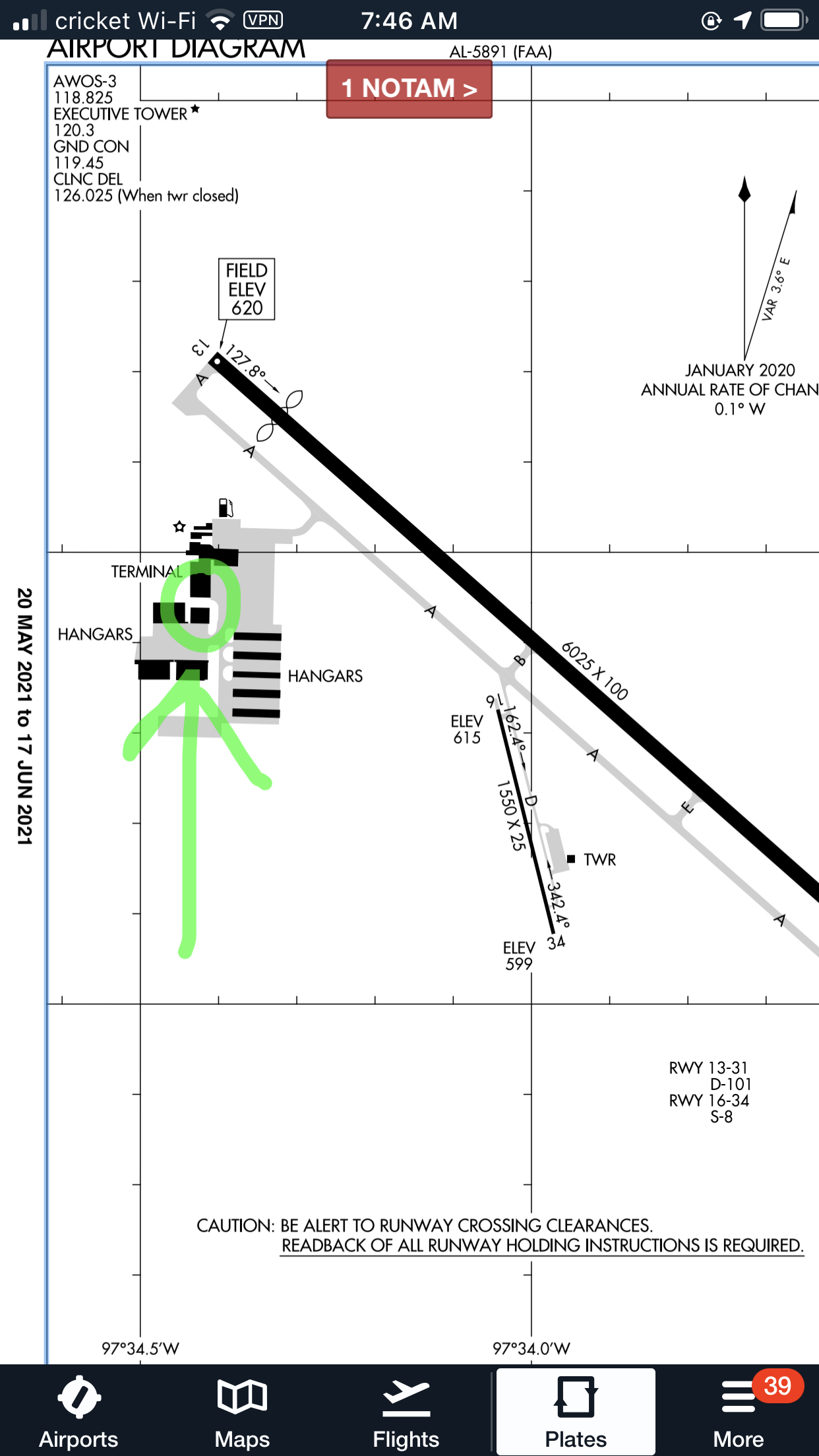
    Austin Executive Airport opened a control tower on Friday, February 23rd 2018.  The airport is now officially Class D airspace.  The charts and A/FD are not updated yet to reflect the tower, but there is a NOTAM with the tower and ground frequency information.  The tower hours are from 6am to 10pm.  The weather frequency remains the same.

    Make sure you check those NOTAMs if you are headed to KEDC anytime soon!

    KEDC Tower Frequency:  120.3

    KEDC Ground:  119.45

Leave a Reply

Your email address will not be published. Required fields are marked *