“AOPA Rusty Pilot presented by AOPA Ambassador Pat Brown at Tempus Training Solutions”
Topic: A Rusty Pilots Seminar
On Saturday, July 16, 2016 at 09:00 Central Daylight Time
Location:
Tempus Training Solutions
2080 Airport Dr.
San Marcos, TX 78666
Select Number:
EA2769634
Description:
Life may have gotten in the way, but the dream of flight can be yours again. Returning to the skies is not as difficult as most rusty pilot think. We’re inviting you back in the cockpit and will help you get there. Come and participate in a FREE Rusty Pilot program with fellow lapsed pilots. We will help you understand what’s changed in aviation since you’ve last took the controls and brush up on your aviation knowledge. The Rusty Pilot program is developed by AOPA in partnership with local flight training providers in order to create the best environment for getting you back in the air and a part of the general aviation community.
It is easier than most people think:
No FAA checkride or test
Medical may not be required
As a Bonus, by attending, you get two to three hours of free ground instruction towards your flight review!
An 8 seat, cabin class, single engine turboprop is set to come to market in 2018 from the new aviation conglomerate Textron Aviation (Textron owns Cessna, Hawker, and Beechcraft). Details were announced last week at the European Business Aviation Conference and Exhibition. The as yet unnamed aircraft will be equipped with Garmin’s G3000 avionics and will be outfitted with a GE 1,240 Shaft Horsepower engine.
The GE engine will be equipped with a FADEC (Fully Automated Digital Engine Control) computer that will allow the pilot to make all necessary power adjustments using just one lever.
Range will be about 1,600 miles at 285 knots, giving the airplane the same legs as a PC12 at slightly faster speeds, but a smaller cabin. The cabin will be equipped with a belted lav if desired.
Ever since I moved out to the Philadelphia area, the Hudson River corridor in New York City has become one my favorite places to fly. It’s hard to overstate the beauty of the city from low over the river. Every time I have a family member or friend come to visit, I try and take them over to see the city from the air.
Each time I fly up the river I can’t believe that we are actually allowed to do so, flying below the tops of the buildings and close enough that you feel that you could reach and out touch them. The draw back to the Hudson River Corridor is that it can be busy, intimidating, and confusing. However, with some reading and preparation, the Skyline flight is easy to do and extremely rewarding.
Having the right weather is an important first step. The second step is try to arrive during ideal lighting conditions. If possible, select a smooth, calm day to make it easier to maintain a track down the correct side of the river. I always try and target arrival at the city around sunset. The view is spectacular any time of day, but having the lights from the city while the sun is just setting gives the best viewing. I’ve also flown over and done the whole flight after dark, which is always spectacular.
View of the World Trade Center
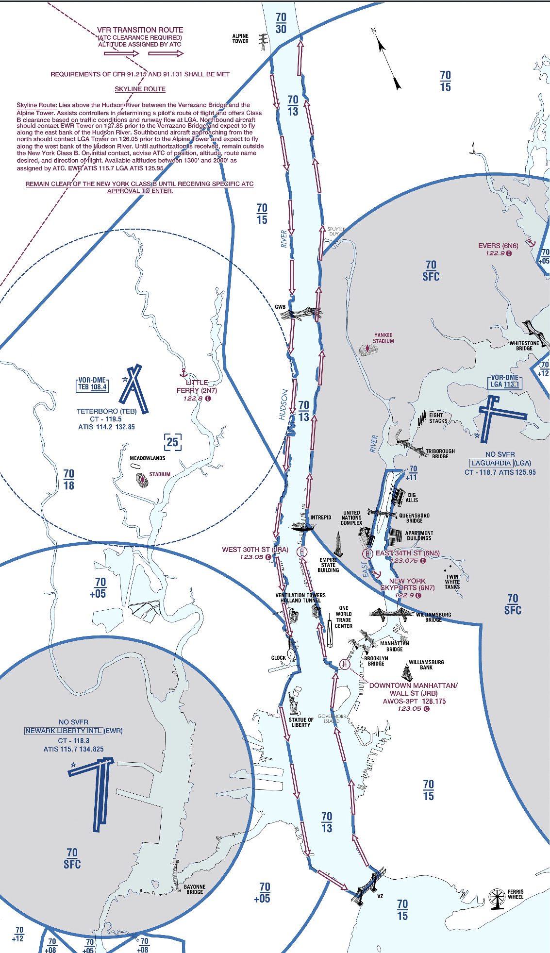
The first method of flying the river is to utilize VFR flight following. If the controllers aren’t too busy, they will provide advisories to aircraft that request the Skyline. The nice thing about doing it this way is that the controller will clear you into the NY bravo airspace and keep you above the traffic flying the Skyline in the VFR corridor below. This is the method that I have always preferred as I enjoy the added benefit of the traffic advisories and it’s nice not to worry about position reporting on the radio.
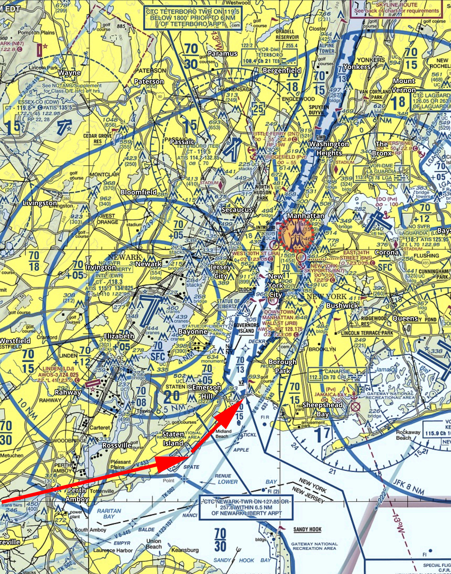
If you want to get flight following, head toward the corridor and request the Skyline route with NY Approach. (Remember to stay clear of the Bravo until you’re cleared in!) Once you’re cleared into the Bravo and approaching the corridor, they will hand you off to Newark/ LaGuardia Tower for traffic advisories over the river. I like to approach from the south and ask for a 180 over the George Washington Bridge. This allows me to fly past the city a second time before exiting the corridor over the VZ (Verrazano Bridge) and heading back toward home.
In red is the path I typically fly. I descend to 1400’ and fly toward the APPLE intersection picking up the shoreline around Staten Island and hugging it until crossing the middle of the VZ. Newark normally clears me into the Bravo at 1400’ or 1500’ to fly up the corridor.
Pros:
Better traffic Awareness
No position reports
Cons:
Flying slightly higher reduces the view
If the controllers are busy, they may deny your request for advisories
Can be intimidating to talk to NY Approach/ Newark/ LaGuardia
The other option is to fly in the VFR corridor. If you want to do it via this method there are just a few things you need to make sure you’re familiar with before you go. When in the VFR corridor you’ll need to make required position reports on a CTAF frequency. Make sure that you have the proper charts and have studied pictures of the landmarks so that you know what you’re looking for. I tend to plan on this as a backup in the event that the controllers won’t give me advisories.
Pros:
Doesn’t require talking to controllers/ class B clearance
More freedom to select altitude and routing as desired
Cons:
Less traffic awareness
Required position reporting
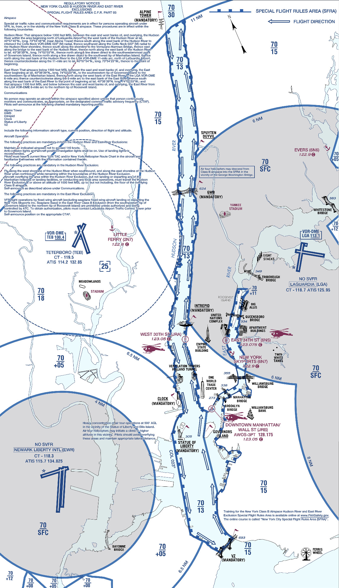
All the requirements and guidelines for flying the corridor can be found on the back of the NYC TAC chart. Any pilot flying the river is required to have one of these or a NYC helicopter route chart on board. If you’re using Foreflight, look in the Documents section under FAA Fly Charts and select the NYC TAC chart in order to read the back of page.
Below you’ll find examples of the diagrams/ instructions printed on the back of the NYC TAC charts.
You can see the traffic flow requires northbound airplanes to hug the east side of the river, while the southbound traffic stays on the west side. The VFR reporting positions (listed from North to South) are: Alpine Tower, George Washington Bridge, Intrepid aircraft carrier, Goldman Sachs (clock), Statue of Liberty, VZ (Verrazano Bridge). Each position report should include aircraft type, position, direction, and altitude.
Other things to be aware of: NYC is always a hotspot for TFR’s. There are often TFR’s for baseball games or presidential movements so make sure to check before you head that way. Additionally, there is a speed restriction in place of 140 kts, though I’m not sure why anyone sightseeing would want to go that fast anyhow.
I realize that all of the procedures and restrictions can be overwhelming, but with the proper preparation, the Hudson Skyline is one of the most incredible places in the world to operate an airplane. There are a lot of things that are easy to get excited about that don’t live up to expectation, but this isn’t one of them. I’ve never taken anyone to the river that wasn’t impressed by what they saw and that’s why I plan to keep going back.
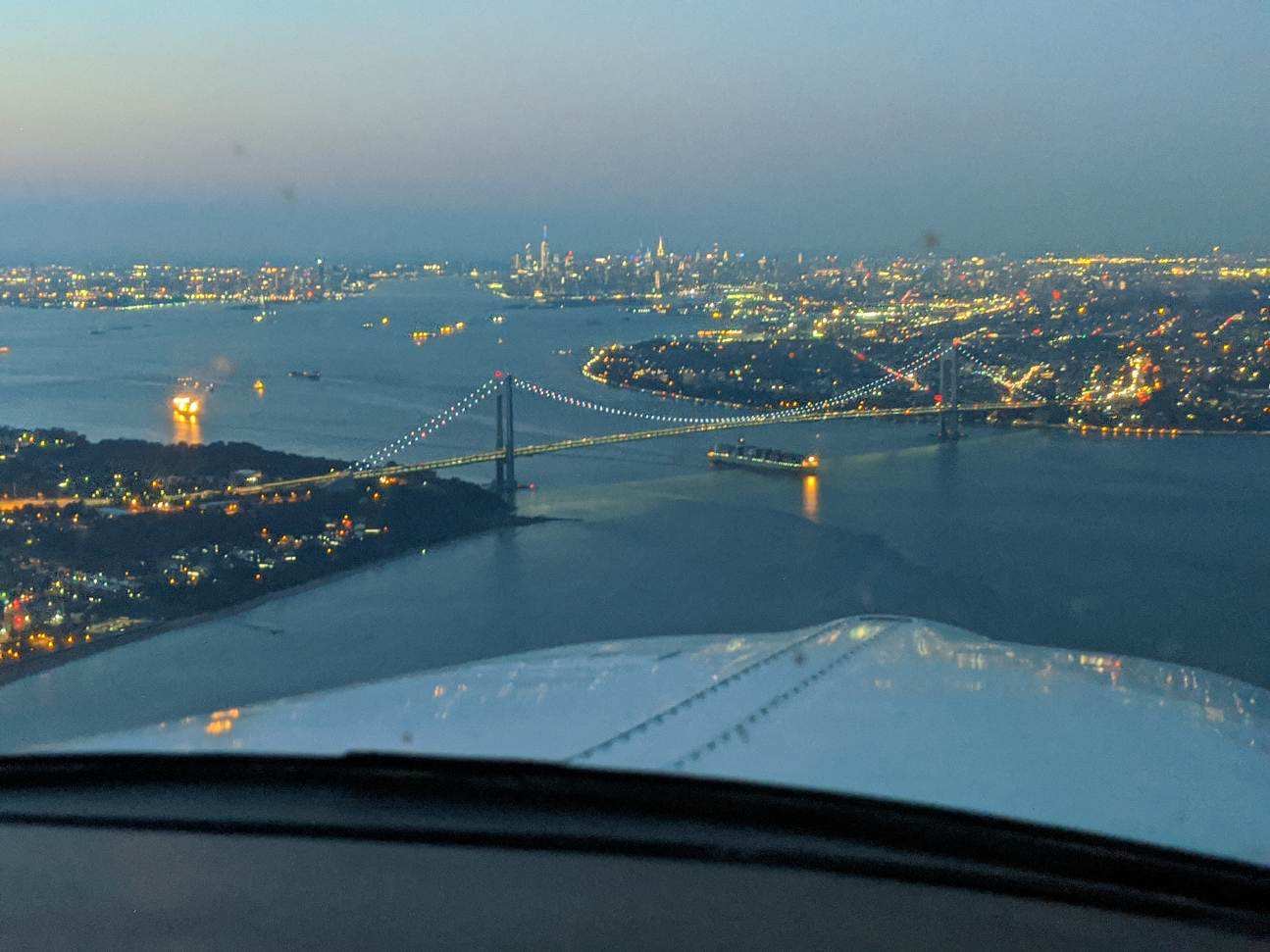
About to cross the VZ looking north toward the city
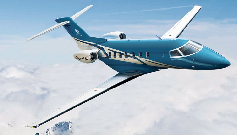
The Pilatus Jet, the PC-24 Super Versatile Jet, is nearing certification. Pilatus expects the Pilatus Jet to receive European and US certification by December. The first delivery may even take place before the end of the year.
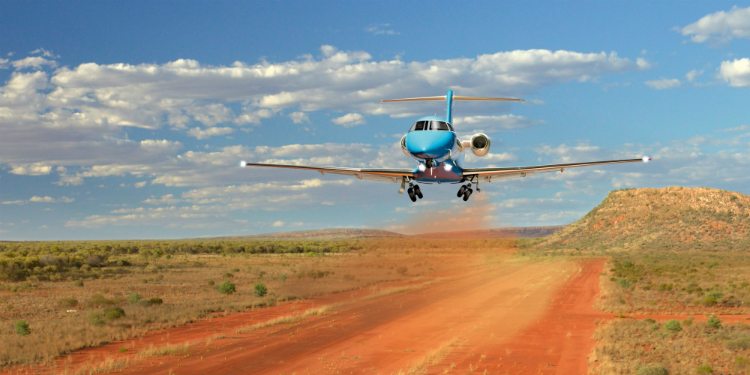
In developing the PC-24 Pilatus Jet, Pilatus, based in Switzerland, has taken the same approach as they did with the PC-12, their insanely successful single engine turboprop. Versatility is the key, with their mindset being to make the PC-24 Pilatus Jet the first flying Suburban jet. Pilatus emphasized STOL and unimproved strip operation in their design.
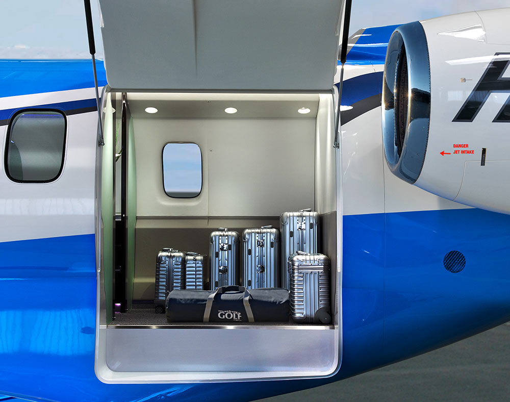
The huge cargo door so familiar on the PC-12 has been crafted into the PC-24 Pilatus Jet giving access to a massive cargo area. According to Pilatus’ website, the jet has a takeoff distance of only 2,690 feet, which is unheard of for a a business jet. There is seating for 11 + a pilot (yep, it’s a single pilot airplane!), so the whole family can come along. With a max cruise of 425 knots and a range of almost 2,000 miles, it’s a get somewhere airplane.
The price tag for a new PC-24 Pilatus Jet will be $8.9 million, which is just under what a new Phenom 300 costs. There is a 90 order wait list, so if you get on it now, you can get one faster than a Cirrus Vision Jet!
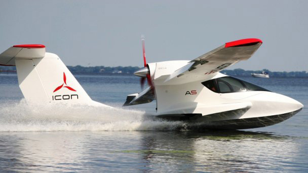
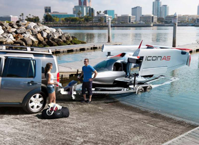
Most pilots have seen the Icon A5 light sport amphibious aircraft. It’s a neat design that can land on water or on a runway. The high wing design with a pusher prop has foldable wings that allow it to be put on a trailer and towed behind a vehicle, allowing it to be offloaded at boat ramps (it also begs the question can you wakeboard behind it?).
Apparently, not all non-pilots know about the Icon A5. Last week, one landed in the water near a beach in Southern California, but most of the beach goers and local authorities believed it had crash landed in the water. Emergency crews were dispatched, but everyone was surprised when the two occupants crawled out on the wings, had a cup of coffee, and took back off.
I love Lightspeed headsets. They are very comfortable, durable, and reasonably priced. Plus, when you call Customer Service, you are actually talking to someone who works for the company and knows what they are talking about.
One thing to watch out for with Lightspeed headsets is the Mono vs. Stereo option. On the Zulu 3, there is a very small control panel underneath the battery compartment to change from Mono to Stereo. If you have any kind of modern audio panel, you will definitely want to do this. Here’s why.
I was flying in a Cirrus SR22 G5 last fall with a Garmin 350 Audio Panel. Everything worked fine talking to the ground and tower controllers. Once I took off and was switched to approach, everything went quiet. I could hear the approach controller, but couldn’t transmit. I thought my headset had bit the dust. There was another set in the plane that I switched to, but I thought the transmit function of mine was out.
I sent the headset back to Lightspeed for repair. The headset was still under their 5 year warranty, which is really nice! I got it back a few days later, plugged it in to another Cirrus, and still had nothing. I was getting frustrated, but then a light went on. One of my colleagues had mentioned something about mono and stereo in the Lightspeed. I popped the batteries out, flipped the switch over to stereo, and wa-la! Everything was fully operational.
If you get Lightspeed headsets, you’ll want to make sure it is set on Stereo, as they all come from the factory on Mono. If you get a PFX, there is an easy access button on the side of the battery unit to switch from Mono to Stereo.
Looking for somewhere to take a trip this fall? Sedona, Arizona should warrant strong consideration. Just shy of 100 miles north of Phoenix, Sedona is one of the most beautiful areas in the southwest United States. From Texas, depending on how fast your airplane travels, you could make it to Sedona in a day, with a couple of stops in between. You’d definitely want to spend a few days to enjoy the scenery and maybe jump over to the Grand Canyon while you’re in the area.
The Airport
As you approach the Sedona Airport (KSEZ), you become somewhat distracted by the scenery around you. Don’t be too distracted as the approach is a little tricky. If you are landing north, on Runway 3, the calm wind runway, don’t let the surroundings fool you. Stay on that PAPI and don’t be short, as the runway is on a 500 foot mesa. In instrument conditions, the MDA for the RNAV approach to Runway 3 dumps you out about 1,300 feet above the airport elevation, giving you plenty of time to set up to land.
When using runway 21, don’t make your pattern too wide as there are some pretty tall rocks (around 7,000 feet) north of the field. The Airport/Facilities Directory gives a warning to pilots in strong southwesterly wind conditions. Be aware of strong downdrafts coming in on final for runway 21.
The runway itself is in excellent condition, and plenty long at just over 5,000 feet. The FBO is a little dated, but the folks there are great. They were redoing the ramp this summer, so beware of that. Airplane parking is no problem, but actually getting to the FBO is a little tricky. The Mesa Grill is a very nice good restaurant just a short walk from the FBO. When I was there, I chowed down on a buffalo burger. It definitely hit the spot.
What To Do
Sedona is the outdoorsman’s paradise. Starting off, to get a great overview of the area, hop on the Red Rock Scenic Byway (SR 179) about an hour before dusk. You’ll get to see some spectacular views while it’s still light, then you can’t beat the sunsets in Sedona.
For hiking, you have a myriad of options, from the Cathedral Rock, to the Oak Creek Canyon, to the Devil’s Bridge Trail, all are beautiful, though most are not for the faint of heart (especially the Devil’s Bridge). Even though the fall is cooler, make sure you pack plenty of water for the hikes.
Want something to do in the evening? Go up to the Chapel of the Holy Cross to watch the sunset. After the sun goes down, go do some stargazing. You’ll get to take a tour of the stars at the Sedona Star Gazing location in Oak Creek. You are shown all the constellations and stars by professional astronomers, and blankets and chairs are provided.
Art connoisseur? You’ll find plenty of art galleries around town with a ton of beautiful, original artwork. There are also several theaters and golf courses around Sedona, giving everyone a little bit of everything.
If you’re up for it, the Grand Canyon is about a 2 hour drive north of Sedona, or a quick flight up to the Grand Canyon Airport (KGCN).
In search of a good getaway? Try Sedona. You’ll be sore from lots of hiking and sight seeing, but it will definitely have been worth it.