Garmin 430 Guide By Pilot Workshops

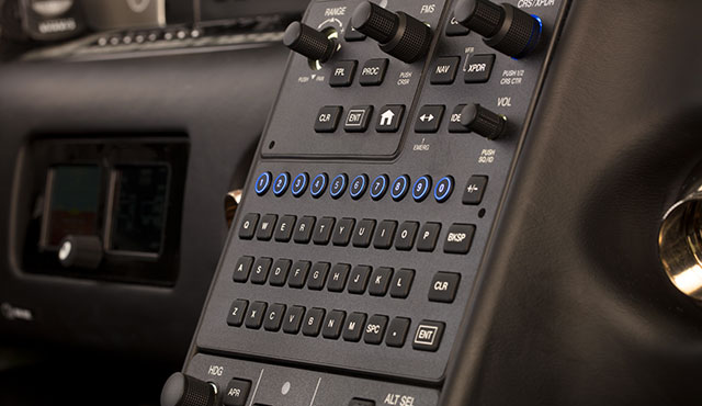
Are you still trying to master the Garmin 430 in your airplane?  Is it giving you fits because you keep twisting the big knob instead of the small knob?  Would you like a step-by-step guide to each and every part of the Garmin 430?

Garmin 430 GuidePilot proficiency website PilotWorkshops.com has published a very thorough, step-by-step manual on how to use the Garmin 430.  Want to load a flight plan?  There’s a section for that.  Want to load an approach?  There is a section for that as well.

The Pilot-friendly Garmin 430 manual is a great reference to have for Garmin pilots.  Pilot Workshops offers a guide for the Garmin 430 and the Garmin 430W, depending on if you have WAAS or not.

The hard copy guides are $44.95, but you can also download the PDF version of each for $19.95.

To get more information on the guide or to order one, you can visit the Pilot Workshops website. (Have another Garmin or King GPS unit?  Pilot Workshops has guides for a variety of different GPS units)

Similar Posts

  • The Diamond DA62: The Ultimate Twin

    Late last year, the Diamond Aircraft Corporation announced a brand new twin engine, the Diamond DA62. At first glance, this is a pretty cool airplane.  It seats 7 passengers, spread out amongst 3 rows, with 2 massive doors, leading to an “SUV” type feel, according to Flying Magazine.  That is only one of the “neato” features of the Diamond DA62.

    The thing that will make pilots believers is the fuel burn.  According to Flying Magazine, which did a test flight of the airplane, at 14,000 feet and 60% power, the airplane was only burning 12 GPH, but still doing 170 KTAS.  Remember, this is a twin.  That’s about the same as a normally aspirated Cirrus SR22 at the same altitude.

    Diamond DA62

    How does Diamond do it?  Jet A.  The company put two Austro AE330, 170 Horsepower, Jet A burning piston engines on the Diamond DA62.  You may say, well, yeah, at 60% power, that’s great, but I want to go places. How much fuel does it burn then?  Even at max continuous power of 95%, it’s still only burning 18.5 GPH total and cruising at 195 knots.  Paying Jet A prices, that’s pretty sweet.

    The range on the airplane is quite nice too.  Again, according to Flying Magazine, the range with full fuel (86.4 gallons with aux tanks) is about 1,300 miles.  You can carry the whole family too, as the full fuel payload is 1,000 pounds.  Golf clubs?  No problem.  Just stick them in the nose.

    The Diamond DA62 is probably one of the easiest twins to manage, engine-wise, too.  The Fully Automated Digital Engine Control (FADEC) system that Diamond installed leaves the pilot with only 2 power levers, instead of 6 on the typical piston twin.  All that needs to be done at cruise is set a percent power and the FADEC computer does the rest.

    Need air conditioning, built in oxygen, and TKS?  Diamond can set you up.  The G1000 system complete with digital backup instruments is standard in the airplane.  What more can you really ask for?

    If you haven’t figured it out, I really like this airplane and would be aching to fly it.  I enjoy the DA40 and have a good amount of DA42 experience, but I’d really like to hop in a Diamond DA62.

    Read the whole Flying Magazine article here.

    Sources:  Flyingmag.com

  • Airspace Alert: Houston Executive Tower Opens

    For those of you who frequent the Houston area, make sure to check your NOTAMs.  The Houston Executive Airport (KTME) in Katy recently opened a control tower.  The Houston Executive tower information won’t show up on the sectional chart till the new chart comes out in the spring.  The only way to get the information about the tower and the airspace will be via NOTAMs or when the new Airport/Facilities Directory comes out on November 3rd.  The tower opened October 1st.

    According to AOPA, the airspace will remain Class G around the airport, even though there is a control tower in place.  Since the Houston Executive tower is there, it will be mandatory to contact the tower when passing through the airspace.  KTME’s airspace stretches up to 2,000 feet MSL and goes out to a 4 sm radius around the airport.  It is a VFR Only tower, so the controllers do not have radar.

    The tower is open from 6am-10pm, local time, 7 days a week.

    Frequency Information

    Houston Executive Tower:  126.975

    Houston Executive Ground Control/Clearance Delivery:  132.075

    Houston Executive ATIS:  119.525


  • Cirrus Pilot Proficiency Program (CPPP)-Conroe, KCXO

    The Cirrus Pilot Proficiency Program is coming back to the Lone Star Airport in Conroe, TX (KCXO) on October 23rd-25th.  Wondering what the CPPP program is?

    “CPPP offers a weekend event for Cirrus owners and their partners that focuses on Cirrus-specific knowledge and flying proficiency.  We bring some of the most experienced flight instructors who regularly teach in all kinds of Cirrus airplanes flown for all kinds of missions.  We have prepared an extensive syllabus of ground courses that complement the transition training and delve into areas of greatest need for Cirrus pilots.” (from CirrusPilots.org)

    CPPP

    The weekend starts off with a group dinner on Friday night. The Saturday morning ground session focuses on General Aviation Safety with special focus on the Cirrus accident statistics.  Normal and emergency procedures are also reviewed.

    In the afternoon on Saturday, the attendees are split into two groups.  The first group has a myriad of options for ground sessions covering all topics related to Cirrus aircraft and operations.  The second group flies, then they switch for the second 3 hour session.  Sunday brings the same split, with more courses offered and more flying.

    While the Cirrus pilots are flying and learning more about their airplanes, CPPP offers a Partner in Command course for flying partners on Saturday.  This allows flying partners to be more comfortable in the airplane and teaches them what to do if something were to happen to the pilot.

    All in all, attending a CPPP will improve both Cirrus knowledge and Cirrus flying skills.  It’s highly recommended for all Cirrus pilots.

    To register for the CPPP event in Conroe, check out the CPPP website.

  • Inadvertent IMC Entry

    I ran across the story about the Korean Air flight that crashed in Guam in the late ’90s the other day.  It was a 747 that hit the side of hill about 3 miles short of the runway, killing most of the people on board.  The flight was at night (arrival time was about 1:30am) and the pilot’s lost sight of the runway on a visual approach due to inadvertent IMC entry.  They didn’t execute a missed approach soon enough, got too low, and crashed.

    Korean Air Crash

    These were experienced pilots, mind you, who had flown into that airport a number of times. They were experienced enough to know when to execute a go around.  There were several other factors that led up to the crash, but, ultimately, they lost sight of the runway due to inadvertent IMC entry.

    To all the VFR pilots out there, what do you do if you accidentally fly into a cloud?  It’s a lot easier to encounter inadvertent IMC at night, simply because you can’t see the clouds in front of you.  It is no less dangerous during the day, either.

    So, we’re going back to the basics today.  What really is the best course of action for a VFR pilot when flying into a cloud?  One option (and in my opinion, the best option) is to turn around. Immediately start scanning your instruments, execute a shallow banked 180 degree turn while maintaining altitude, and fly out of the cloud you just flew into.  If you have an autopilot, turn it on immediately and let it do the turn.

    What if you were descending or climbing when you encountered the inadvertent IMC?  In this case, just reverse whatever you were just doing.  If you were descending, climb.  If you were climbing, descend.  Caution is needed, though, as climbing or descending when flying on instruments for an inexperienced IFR pilot could lead to a greater chance of disorientation.

    One thing that could assist in spotting those clouds at night is turning the cockpit lights down.  This will allow you to see outside a little bit better and start to notice when those ground lights are disappearing.

    IMC FlightMost VFR pilots only do instrument flying on flight reviews.  That doesn’t lead to a very high level of proficiency, so go out and grab your instructor and tell him to put you under the hood once a month.  You’ll be a better pilot overall for it.

    IFR pilots, taking a note from the Korean Air flight; if you lose sight of the runway on a visual approach, especially at night, go missed and ask for the instrument approach procedure.  Don’t try and duck down below the clouds as there may be a hill or a mountain directly below you.

  • Reading Weather Prog Charts

    There are a multitude of weather products out there today to assist pilots in preparing for a flight.  Aviationweather.gov is the best source for getting all the information a pilot needs for planning a flight.  Aviationweather.gov is the National Weather Service’s source for all aviation related weather products.  When I teach about weather and weather briefings, I recommend to my students to utilize Aviationweather.gov in the planning stages, but still call the Flight Service Station to get a full fledged weather briefing before takeoff.

    When preflight weather planning, one of the best ways to get a picture of what is happening over a broad area is utilizing the Low Level Significant Weather Prog charts.  The Prog chart gives a forecasted 12 and 24 hour picture of what type of weather to expect over the US.  The Prog chart gives the expected flight rules, areas of turbulence, and where the freezing level is located.  If you’re looking at the 4 panel view, the Surface Prog chart shows fronts, pressure areas, and areas of expected precipitation.  That covers just about everything, doesn’t it?

    I believe the Prog charts are underutilized in planning.  Foreflight and Garmin Pilot have given easy access to radar pictures, satellite pictures, METARs, TAFs, and several other sources of weather information.  But, a lot of the easy access data you can get from those apps is current data (with the exception of the TAF) while a lot of the forecast data takes some hunting around.  So, products like Prog charts aren’t often utilized.

    The other problem arises when pilots know about Prog charts, but don’t know how to read them, then don’t know how to find the legend to decipher the chart, the chart is often set aside and quickly forgotten about just because of a lack of knowledge.  Have no fear, though, as now we will use an example 4 panel Prog chart to decipher the lines and colorations.

    Low Level Sig WX Prog

    Just looking at the Low Level Significant Weather Prog Chart above, it can be a little confusing.  That’s why they make a legend!

    Low Level Legend

    Coupling the legend with the chart above, we can determine some things.  First, California, parts of the Pacific Northwest, a small part of southern Arizona, and a good portion of the Midwest and East coast are going to have marginal VFR conditions in the next 12 hours.  Wisconsin, Illinois, a good portion of the Northeast, and a small portion of the Pacific Northwest will suffer IFR from IFR conditions.  There are going to be a good amount of low level turbulence in the northern and eastern parts of the country.  Finally, the freezing level starts at the surface running in a jagged line across the midwest states and curling up into the Northeast.

    That’s a good bit of information, isn’t it?  If a pilot is planning a VFR flight into the Northeast tonight, it would probably be best to wait for another day, according to this chart.

    Now, to see what is causing the conditions above, we need to look at the Surface Prog Chart.

    Surface Prog

    The green circular areas above show that some form of precipitation is in that area.  The circular dots with the triangle located in Mexico and Baja California are depicting moderate rain showers.  If the triangle was gone, it would just be moderate rain.  In the northeast, all those symbols are showing moderate to heavy snow showers.  Across the plains, we see a lot of high pressure, meaning visibility and nice flying weather.

    These charts are invaluable when it comes to flight planning, especially over long distances when the weather could be changing a lot over the period of your flight.  Put them to use the next time you are planning a trip and you’ll learn you have a much better picture of what the weather is doing.

  • I Love the Piper PA46

    A lot of my customers ask me which airplane that I train in is my favorite.  The Cirrus and the Columbia both are very good airplanes, but if I had my pick, I’d go with a Piper PA46, specifically an ’86-’88 Malibu.

    I love the Piper PA46.  6 seat, cabin class, pressurization, air conditioning, great ramp appeal, 17 GPH (in the Continental TSIO 520 or 550; Piper changed to the Lycoming TIO 540 in ’89, which you run rich of peak and burn 22 GPH, decreasing a little bit of the awesomeness).  What more can you ask for?  The interior is roomy, there is plenty of baggage space in the nose and in the rear of the cabin.  They are downright fabulous airplanes.  Plus, you can get into a nice one that has had some panel upgrades and a mid time engine for around $300,000.  That’s not bad.

    Cessna tried to make a pressurized single with the P210, but it just doesn’t match up with the Piper PA46. The Piper has more room, more baggage space, a higher max differential pressure and service ceiling, and better air conditioning to boot!

    Don’t know much about the Piper PA46?  It’s been called several things.  Originally, it was the Malibu, with a Continental engine.  Now the TSIO 520 was not one of Continental’s better motors.  However, most of the original Malibus have been upgraded to the much better TSIO 550C engine, which is a great product. Cruise around at almost 200 knots at FL200 and burn only 17 GPH.  It’s beautiful.

    Piper changed to the Lycoming engine in 1989 and changed the name to the Malibu Mirage, later shortened to just Mirage.

    Then, in 2016, Piper upgraded a lot of the avionics, cleaned up the panel, and dubbed it the M350.

    Piper made the ill fated decision in the mid 2000s to quit making the Saratoga and instead make an unpressurized version of the PA46 called the Matrix.  It didn’t last long, only about 10 years or so, and hasn’t been very popular (see:  don’t buy one).  Piper took the best part about the PA46, the pressurization, and took it away, leaving an airplane that you still have to wear oxygen in to get the advertised high speeds in the upper teens and flight levels.  Who wants to be cruising around in a cabin class airplane with oxygen on?  Piper needs to bring the Saratoga back to give folks a low level, high performance option.

    What would be my dream Piper PA46?  As stated above, an ’86-’88 model Malibu (Piper started off with hydraulic flaps in the ’84-’85 models and it wasn’t a very good system.  They changed to electric flaps in ’86) with a Continental TSIO 550C upgrade.  The Garmin autopilot isn’t out yet, so I’d go with the STEC 3100 Autopilot w/ a Yaw Damper (the airplane originally came with a King KFC 150, which is a really good autopilot, but most of them are getting old and are getting difficult to fix.  King’s replacement KFC 325 is still slogging through certification.  Garmin’s GFC 600 would be ideal, but that isn’t expected to be certified for the PA46 fleet till late this year).  A single Garmin 10.6″ G500 TXi with EIS tied to a Garmin GTN 750 GPS with a Garmin GTR 225 Nav/Comm as the number 2 radio.

    Then I just put gas in it and go.  That would be my kind of airplane.

Leave a Reply

Your email address will not be published. Required fields are marked *