|

AOPA Air Safety Institute: More Difficult Decisions

The AOPA Air Safety Institute is making it’s annual loop through Texas this January. The topic for this Safety Seminar is “More Difficult Decisions: Choices & Consequences.”

The seminar is geared our the decision making process that we as pilots face on each flight. Some decisions are easy (what altitude should I pick?) while some have much greater consequences and should be taken very seriously.

This event will be interactive for the participants as several scenarios will be presented. The goal is to help pilots learn to think through each decision, weighing the consequences along the weigh to arrive at the safest outcome of the flight.

The first area seminar will be held on Tuesday, January 21st at the Stinson Field Airport (KSSF, 8535 Mission Road, San Antonio, TX 78214). The second area seminar will be held on Wednesday, January 22nd at the TXDOT office in Austin (200 E. Riverside Dr., Austin, TX 78704). WINGs credit is available for all attendees.

Learn more here.

Similar Posts

  • That Pesky Rudder

    Whenever I get in an airplane with a pilot for recurrent training, I can assure myself that I will mention rudder usage more than once during the flight.  If it is in a tailwheel (or if the pilot is doing tailwheel training), I’m going to mention the rudder a lot.  How do I know this?  Because basic rudder skills are actually one of the most difficult things to master in flying.

    Let’s start simple.  What does the rudder do?  The dictionary definition is it controls the movement about the vertical axis of the airplane.  If you stick a pole down through the CG of the airplane and rotate the airplane around that pole, this is the vertical axis.  Looking at it another way, the rudder moves the airplane’s nose left and right.  Keep this in mind as we move on.

    Rudder

    Every pilot thinks about the rudder during the takeoff roll.  Because of the torque effect, the pilot must add right rudder during the takeoff roll to stay on the runway centerline.  Depending on the airplane’s horsepower, more rudder pressure is needed in higher powered airplanes.  The problem usually shows up once the airplane gets in the air.

    In the worst situation, after takeoff, the pilot will set both feet on the floor and completely disregard the rudder.  Torque effect and now P-factor are continuing to cause the airplane to yaw left, causing the need for right rudder.  With his feet on the floor, though, the pilot is allowing the airplane to yaw.  It’s not terribly noticeable for him in the front seat, but the back seat passengers (especially in a six seat or larger airplane) are certainly feeling it.

    One particular problem spot on the climb is the climbing left turn.  In a climbing left turn, training says to add left rudder since it is a left turn (see below for the reasoning).  But, since the airplane is climbing and therefore experiencing left yawing tendencies due to the aforementioned effects, the pilot needs to continue pressing the right rudder, though the pressure won’t be as much as in a straight climb.  Watch the ball the next time you make a climbing left hand turn and it’ll make a believer out of you.

    I find only a handful of pilots are this egregious.  Most pilots have rudder problems in turns and in turbulence.  We’ll tackle turns first.  As we all learned when we first started flying, due to adverse yaw, a pilot must add rudder in the turn’s direction.  Again, this isn’t usually where the problem shows up.  During the rollout is the problem area.

    Let’s take a turn to the left.  The pilot rolls in, adding left rudder, arrives at his heading, then begins to roll out with the ailerons.  Left adverse yaw is now being experienced and right rudder is needed to smoothly transition back to level flight.  Need some visual assistance?  Watch the nose the next time you make a turn. If you are working the rudder properly, the nose will pivot on one point in the horizon.  If you aren’t using the rudder properly, the nose will draw a U shape on the horizon.  Try making some turns without rudder, see what it looks like, then use the rudder properly.  You’ll notice a big difference.

    Finally, let’s talk turbulence.  As we all know, turbulence in the hot summer afternoon is quite pronounced. When the airplane experiences a bump, it usually doesn’t bounce straight up in the air.  There is usually some kind of rolling motion involved.  As the pilot corrects this rolling motion by moving the ailerons, adverse yaw is experienced (just like rolling into and out of a turn that we talked about above), so rudder is needed.  There isn’t a need to stomp on the rudder or you’ll cause the airplane to severely yaw in the other direction, but rudder pressure is needed.

    Final approach is where this gets most pilots.  By controlling the nose and not allowing it to move around on final by using the rudder, this will make your approaches a little more stabilized leading to a more successful landing.

    Feeling lost when it comes to the rudder?  Ask your instructor the next time you go fly to do some rudder exercises.  Most instructors don’t emphasize these basic stick and rudder skills which leaves pilots lacking as they move on in their aviation lives.  So make it a point to do some basic rudder work the next time you fly with your instructor.

  • The Do’s and Don’ts of Drones

    This is the second part in a series on drones and Unmammed Aerial Systems (UAS). To read Part 1, Drones: A Brief History, please click here.

    I’m surprised how often I’ve been asked about drones by concerned passengers as they load up for a charter flight. Most commonly I’m asked how many drones I’ve seen while I’m flying, or how many drones I’ve hit/ almost hit. Sadly, the media has made this drone crisis into something that it isn’t. I’ve never seen a drone while I was operating a full scale aircraft, and I’ve certainly never been put into a situation where I felt that a drone was a threat to my safety or the safety of the flight. In fact, I only personally know one pilot who has reportedly seen one around an airport and that was an isolated incident (and a non-event).

    The reality is that while Unmanned Aerial Vehicles can be a real danger to full scale aircraft, incidents aren’t actually all that common and detailed information is often lacking or missing altogether. It is likely that some of the reported drone incidents were actually a case of a pilot confusing a loose balloon or a bird for a drone. This, combined with the media’s sensationalizing of every “close” encounter nationwide has led the public to believe that the problem is much bigger than it actually is.

    In actuality, when the AMA (Academy of Model Aeronautics, the USA’s governing body for model aircraft) analyzed the data from the FAA’s 764 recorded Drone sightings, only 27 of them (3.5%) were actually recorded as “near misses” or “near collisions.” Additionally, only 10 of the records (1.3%) indicate that pilot was required to take evasive action.

    The records also include reports of drone sightings at altitudes which would be impossible for civilian models to attain (19,000-24,000′). Finally, some of the sightings took place in areas which are specifically set aside for model aircraft and drones to operate.   In those cases, the person flying the drone when it was reported was actually doing so in a safe and legal manner in an area designated for that specific purpose. If you’re interested, the whole article is available here and has a lot of great information.

    As pilots, it is important that we do our part in helping reduce the risk of drone strikes. The biggest thing that we can do to help is to report any activity that we see so that it can be investigated and hopefully the drone operator can be found and dealt with. Try to get as much detail as possible about the incident, such as the size, color, location, direction and altitude of any sighted UAVs and report it to the closest tower or controlling agency.

    Recently, the people in Washington have come up with a bunch of new rules to regulate the operation of model aircraft. As of this year, every unmanned aerial vehicle between 0.5 and 55 lbs must be registered with the FAA and have an FAA issued registration number located on the model itself. The logic here is that if someone crashes a drone where it shouldn’t have been operated, the officials will be able to identify the owner of the model and take action.

    Model manufacturers and vendors have also agreed to start providing information about a program called “Know Before You Fly” (KBYF) in the packaging of the drones.  This program seeks to help educate new hobbyists to the rules and responsibilities associated with model aviation. For more information on KBYF, here is a link to their website.

    In the end, the sad reality is that it’s a combination of many factors: new technology making models cheaper and easier to fly, GPS navigation and automation, the media blowing the incidents out of proportion, and inexperienced and foolish operators which have caused the growing concern and required the FAA’s action. I think that it is important to understand that thousands of people have been flying radio controlled models for many years responsibly and this has never been a problem. The AMA has rules (which are the same ones now adopted by the FAA) regarding flying location, altitudes, speeds, and more which have kept both the modelers on the ground and the pilots in the air safe until now. Its a classic case of a few foolish individuals who have caused all modelers to be cast in a bad light.

    Birds and Airplanes

    There is no reason to fly in fear, though. A pilot should always be watching for hazards as he or she is flying, regardless of the variety. In fact, according to the FAA’s website, there were 142,000 wild life STRIKES with civil aircraft in the USA between 1990 and 2013. That seems like a much bigger concern to me than the 764 reported drone SIGHTINGS. As with any new technology, drones are suffering from growing pains. As the rules fall into place and new operators become better experienced, hopefully we will hear about fewer incidents on the evening news. Anyway, I’ll stop “droning” on. Fly safe.

    Andrew Robinson is a 135 Charter Pilot and flight instructor who lives with his wife and 2 daughters in Pennsylvania.  He flies Pilatus PC-12s and instructs in Beechcraft Bonanzas.

  • Avidyne IFD 440 Receives Certification

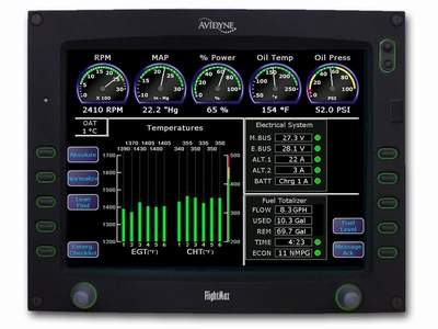
    Avidyne’s plug and play replacement for the Garmin 430, the Avidyne IFD 440, finally received certification from the FAA last week.  The touch screen GPS unit is being marketed as a simple swap out for the Garmin 430.  This release follows up Avidyne’s release last year of the IFD 540, also a plug and play replacement, but for the Garmin 530.

    The features and touch screen of the GPS units sound quite nifty, but it will be hard for Avidyne to compete with the GTN 750 and 650 from Garmin.  The unit prices for the IFD 540 and 440 will be less (and installation is simpler), but we will see how the company does.

    Avidyne IFD 440

    The STC allows for installation in 1,000 makes and models of aircraft, according to the company, so there are a lot of possibilities for installs.

    In conjunction, Avidyne also released a new version of it’s software for both GPS units.  According to Avidyne, this will unlock multiple features that enhances the capabilities of both units.

    To read more on the IFD 440 and it’s bigger brother, the IFD 540, check out Avidyne’s website.

  • How to Get the Current Weather

    For a long time, I was happy if an FBO had a radio where I could tune the ATIS or automated weather before getting into the plane. This would allow me to skip listening to the weather in the airplane with the engine running, giving me a quicker exit from the ramp while burning a little less fuel. I would also be able to brief my taxi route from the ramp since I would know which runway was in use before getting in the plane.

    As we progress forward in technology, I’m constantly amazed at how much more planning I can do from the palm of my hand. Now, I can call a phone number and get the ATIS, AWOS, or ASOS, depending on the size of the airport; if you prefer reading a text version…well, there’s an app for that.

    With this technology, it’s very important for pilots to be aware of what service they are utilizing when calling these numbers. Usually only a Class B or larger Class C airport will have a phone number specifically for ATIS as well as one for AWOS/ASOS. These are listed in the Airport/Facility Directory (AFD), as well as all flight planning apps (Foreflight, Garmin Pilot, Stratus Insight). More then one pilot has called the AWOS/ASOS number for an airport thinking they would receive the ATIS (because towered airports that have ATIS phone numbers often also have AWOS/ASOS phone numbers that are different). Since the pilot didn’t hear a code on the phone, that led to the false thinking that either the tower was closed or the pilot did not have the code (ie. Information Bravo) to give to ground control when calling for taxi instructions.  The minute weather can be very useful for flight planning, but the ATIS must be received before contacting ATC at a towered airport.

    Notice the red box just past halfway down the page. There is a phone number for the ASOS at KSAT and a separate phone number for the ATIS next to the frequency.

    Sometimes, you may get a busy tone if someone else is on the line. Usually, waiting a few minutes and trying again will lead to success. Just like old school phone lines, only one call can go through at at time! If it’s a particularly stormy day, you may be fighting a number of pilots to get on the line. In this case, an app where you can read the ATIS may be particularly helpful (Yes, there actually is a dedicated ATIS App!).

    The ATIS app allows us lowly pilots without an Aircraft Communicating and Reporting System (ACARS) to access the Digital ATIS (D-ATIS ) at airports where ATIS is available. Only 76 airports in the US have D-ATIS, most of which are either Class B or busier Class C airports. Foreflight also provides D-ATIS textually at the same 76 airports, though it is only accessible depending on which subscription level you have with Foreflight (since I’m not a Garmin Pilot or Stratus Insight user, I’m not sure if either of them give D-ATIS reports).

    ATIS App Symbol

    With Foreflight’s D-ATIS, it does not get updated over ADS-B, only when your iPad or phone have an internet signal. When inbound to an airport with D-ATIS, the pilot has to listen to the radio frequency to get the current ATIS. Foreflight will display the last D-ATIS it received, but typically, it’s old. Check the time in the upper right hand corner.

    Foreflight now offers Pre-Departure Clearance (PDC) at those same 76 airports. With either a pre-registered tail number or a Foreflight call sign (starting in FFL), once a pilot files an IFR flight plan, the D-ATIS and the IFR clearance in it’s entirety are texted to the phone number the pilot filed with. All that is left to do is call ground, state “I have information Romeo and my clearance, ready to taxi,” then away you go. Skipping listening to the ATIS and talking to Clearance Delivery saves a good 5-10 minutes at times, depending on how busy the airport is.

    These days, there are many different avenues to get the current weather (and IFR clearances!). When calling on the phone, the key is to be aware, know which number you are calling and, if you are expecting to hear an ATIS message but instead hear the AWOS/ASOS, verify the Chart Supplement Guide and Notices to Airmen (NOTAMS) to check tower hours of operation before flying into the airspace. 

  • Inadvertent IMC Entry

    I ran across the story about the Korean Air flight that crashed in Guam in the late ’90s the other day.  It was a 747 that hit the side of hill about 3 miles short of the runway, killing most of the people on board.  The flight was at night (arrival time was about 1:30am) and the pilot’s lost sight of the runway on a visual approach due to inadvertent IMC entry.  They didn’t execute a missed approach soon enough, got too low, and crashed.

    Korean Air Crash

    These were experienced pilots, mind you, who had flown into that airport a number of times. They were experienced enough to know when to execute a go around.  There were several other factors that led up to the crash, but, ultimately, they lost sight of the runway due to inadvertent IMC entry.

    To all the VFR pilots out there, what do you do if you accidentally fly into a cloud?  It’s a lot easier to encounter inadvertent IMC at night, simply because you can’t see the clouds in front of you.  It is no less dangerous during the day, either.

    So, we’re going back to the basics today.  What really is the best course of action for a VFR pilot when flying into a cloud?  One option (and in my opinion, the best option) is to turn around. Immediately start scanning your instruments, execute a shallow banked 180 degree turn while maintaining altitude, and fly out of the cloud you just flew into.  If you have an autopilot, turn it on immediately and let it do the turn.

    What if you were descending or climbing when you encountered the inadvertent IMC?  In this case, just reverse whatever you were just doing.  If you were descending, climb.  If you were climbing, descend.  Caution is needed, though, as climbing or descending when flying on instruments for an inexperienced IFR pilot could lead to a greater chance of disorientation.

    One thing that could assist in spotting those clouds at night is turning the cockpit lights down.  This will allow you to see outside a little bit better and start to notice when those ground lights are disappearing.

    IMC FlightMost VFR pilots only do instrument flying on flight reviews.  That doesn’t lead to a very high level of proficiency, so go out and grab your instructor and tell him to put you under the hood once a month.  You’ll be a better pilot overall for it.

    IFR pilots, taking a note from the Korean Air flight; if you lose sight of the runway on a visual approach, especially at night, go missed and ask for the instrument approach procedure.  Don’t try and duck down below the clouds as there may be a hill or a mountain directly below you.

  • Iridium Zoleo Allows In Flight Messaging

    Satellite communications company Iridium now has a really nifty little product called the Iridium Zoleo Satellite Communicator. Most pilots who fly newer Cirrus Aircraft will be familiar with the company name Iridium. Iridium manufactures the built in satellite phone that is an option in all Cirrus after 2012. The Iridium Zoleo brings messaging capability to any airplane in a cost effective and simple manner.

    The Iridium Zoleo is a device roughly the size of a walkie-talkie. It links up with the Iridium satellite network to send and receive messages and emails anywhere in the world (or air!). To make things easier, the Iridium Zoleo links with a phone via Bluetooth to a free app that allows the user to write a message directly from the phone and send through the device.

    The Iridium Zoleo is affordable at only $200. A plan has to be purchased in order to send messages, with 3 different levels of subscription offered: 25 messages a month for $20, 250 messages a month for $35, or unlimited messages per month for $50. Each plan offers a $6 upgrade to allow unlimited worldwide breadcrumbs and tracking.

    The Iridium Zoleo has a 200 hour battery life and is designed to be shock, dust, and water resistant. Plus, the device has a built in SOS that can be used anywhere in the world. So, you can take it rafting down the Grand Canyon, hiking in the Andes, flying over the Atlantic, or SOS if you are stranded in the middle of the Indian Ocean.

    Click here to read more about Zoleo and here to read more about the Zoleo plans.

Leave a Reply

Your email address will not be published. Required fields are marked *