AOPA Air Safety Foundation Survival Seminar

The AOPA’s Air Safety Foundation will be returning to Texas this coming week with their After the Crash:  Surviving An Aircraft Accident seminar.  Though aircraft accidents are rare to most pilots, they still happen.  It is best to be prepared with the proper knowledge and supplies in case you are stranded in a remote area while awaiting help to arrive.

The seminar will cover the following items:

  • How and what to pack in a survival kit
  • Ways to help search parties find you
  • What to do first immediately after the off airport landing
  • How to survive will awaiting rescue

The seminar will be put on in Houston, San Antonio, and Austin on three consecutive nights, the 20th-22nd, so everyone will get a chance to attend.  The location and times are below.

No signup is necessary, just show up and be ready to learn.  The seminar does count for WINGs credit and there will be a sign in sheet at each event.

The AOPA Air Safety Foundation puts on numerous seminars throughout the country during the year covering a wide variety of topics relevant to general aviation pilots.  The content is always interesting and the presenter always knowledgeable and entertaining.  Hope to see you there!

Tuesday, January 20th

Wyndham Hotel, Houston West
14703 Park Row Blvd.
Houston, TX 77079
7:00pm-9:00pm

Wednesday, January 21st

Doubletree Hotel, San Antonio Airport
37 NE Loop 410
San Antonio, TX 78216
7:00pm-9:00pm

Thursday, January 22nd

Omni Hotel, Southpark
4140 Governor’s Row
Austin, TX 78744
7:00pm-9:00pm

For more information on the event and the locations, please click here.

Similar Posts

  • King Schools Updates Check Ride Guidance

    King Schools LogoMost in the aviation industry are familiar with John and Martha King, the faces of the myriad of Kings Schools aviation training courses.  Thousands of pilots have gone through their ground school courses for a variety of certificates or ratings, taking in the videos on original VHS, DVD, or streaming online depending on what the current technology is.

    With the advent of the Airmen Certification Standards (ACS) replacing the Practical Test Standards (PTS) for the private and instrument certificates, King Schools didn’t take long to update their material.

    To help private students prepping for their check ride (and their instructors who aren’t familiar with an ACS check ride yet), John King plays the student pilot in the latest King Schools prep video.  The streaming online video is about 5 hours long, includes the oral portion and the flight portion of the check ride, and runs $139 (you can still get the DVD, too!).

    I have recommended King Schools and their courses to all of my customers.  They have always put out a great product as they reduce the fear felt for a check ride applicant.  If you are prepping for your private pilot check ride, checkout the King Schools video today.

  • Weather Avoidance

    I began flying a Piper Malibu earlier this year.  For those of you not familiar with the original PA-46, a Malibu has a Continental TSIO-320 engine, with 310 HP.  It’s pressurized and cruises at about 185-200 KTAS.

    A few things are introduced to the equation when pilots start flying higher, faster, and farther.  When you start flying over longer distances, weather becomes more of an issue.  On a quick hop from, say, Austin to Dallas, you can be pretty sure of what the weather will be since it’s a short trip.  When you fly from Austin to LA, leave in the morning, land once along the way, and arrive in the afternoon after spending six and a half hours in the air, weather can change a lot in that amount of time.

    A must for any pilot flying high and over long distances is some kind of Nexrad system, whether it be a Garmin 696, or it shows up on your GPS or MFD.  Having this situation awareness is very helpful when planning ahead as to what to do about weather.  A stormscope is also a handy tool, since you can see where the lightning is with it.

    Cold fronts can be pretty nasty, depending on how strong and how fast they are moving.  A strong, fast moving cold front usually has a lot of convective activity associated with it.  The tricky thing with storms associated with fronts is that storms form in lines, most of the time.  If you’re trying to cross a front in the morning, you can usually get high enough over the clouds with a pressurized airplane since the temperature is still relatively low to get clear of the cumulonimbus clouds.  The cloud tops will only be around ten or twelve thousand feet.

    CB CloudCrossing fronts in the afternoon when daytime heating is pushing the tops of the CBs up to the 20-40 thousand foot range, it’s best to land, have a meal, stretch your legs, and wait till the sun starts to go down before pushing on.  Do not, under any circumstances, try and go through the cumulonimbus clouds associated with a cold front in a small airplane.  Not only is it uncomfortable (the turbulence bounces you around pretty good), but you’ll get ice, scare the passengers, and, if you’re in the heart of a storm, the plane could come apart.

    When crossing mountains, the weather is always highly unpredictable.  If it’s a clear day, no matter your altitude, you’ll probably pick up some turbulence from all the rising air off the peaks.  If there is moisture in the air, there are going to be isolated to scattered thunderstorms in the summer time.  The advantage of flying high when there are isolated or scattered storms is you can utilize the see and avoid method.

    See and avoid is simple.  When the storms aren’t embedded in other clouds, it’s actually rather easy to spot the big, rising clouds and go around them.  The same concept holds true when avoiding those pesky pop up thunderstorms in humid areas like Houston and Florida.

    Rain ShaftsOne thing that I learned this summer was this.  Sometimes, with an area of closely grouped storms, the cloud base is actually quite high (some storms I went underneath in New Mexico had cloud bases of 15,000 MSL).  The thing to do here is just stay below the bases of the clouds and go around the areas of rain.  These will be visible and you’ll be able to navigate around them.  With bases even as low 9-10 thousand feet, it’s a much better idea to stay below the clouds, sacrifice some speed, and dodge the rain shafts.

    The most important concept to take away is don’t fly into a thunderstorm.  If there are a bunch of really high clouds in front of you and you don’t see a safe way around them, descend down and land, wait it out, and then continue on your way.

  • Fly Away Destination: Lajitas Golf Resort

    Talk about star treatment.  The Lajitas Golf Resort rolled out the red carpet for the 2019 Texas Top Aviation Lajitas Fly In.  I had been to Lajitas twice before; once in July when it was hot, miserable and bumpy.  The second time was the week before our Fly In.  Both times, everyone from the airport folks to the bus drivers to the front desk and restaurant staff were top notch.  It made for a very pleasurable experience.

    If you haven’t been out to Lajitas (or don’t even know where it is) and you’re a pilot (you don’t even have to play golf), you have missed a sure gem.  Lajitas is positioned on the southern tip of the Big Bend area of Texas, right on the Rio Grande river.  Lajitas has great lodging with several different room options from big to small, an excellent restaurant for 3 square a day (and even a bakery for sweets, coffee, and breakfast tacos in the mornings), and a 5 star golf course in Black Jack Crossing.

    Why is this all relevant to us aviators?  Lajitas has it’s own private airport, 89TE.  Complete with a 5,500 foot asphalt runway, VFR conditions most of the year, and reasonable fuel prices, Lajitas is the pilot’s gateway to the resort and the entire Big Bend area.  If you wait until the fall, a brand new, 7,000 foot concrete runway should be completed and an IFR approach should be available.  An AWOS is in the works too.

    The resort and airport are so far south, radar and radio coverage with Albuquerque Center is pretty poor below about 15,000 feet, and non-existent below 10,000 feet.  This isn’t a big concern as any airplanes in the area should be on 122.9 and the airport manager will make contact with you, give you a weather report, and assign a runway.

    Once you are on the ground, there will be a resort bus waiting to whisk you and all your friends to the resort for your getaway.

    The 2019 Texas Top Aviation Lajitas Fly In was a big hit.  We had 7 airplanes total:  5 Cirrus SR22s, 1 Piper Matrix, and 1 Citation M2.  There were 15 attendees total, including 13 golfers.  Everyone raved about the resort and the golf course.  The only hiccup in the weekend was the cold front that blasted through on Friday afternoon, kicking up a lot of dust.  Golfing on Saturday was windy too, but Sunday morning was absolutely perfect.

    Thanks again to the folks at Lajitas for the star treatment!

    Interested in participating in the next Texas Top Aviation Fly In?  Contact Us or Sign Up for Our Newsletter and we will make sure you find out about the next one so you don’t miss out!

  • Textron Aviation’s New Single Engine Turboprop

    An 8 seat, cabin class, single engine turboprop is set to come to market in 2018 from the new aviation conglomerate Textron Aviation (Textron owns Cessna, Hawker, and Beechcraft).  Details were announced last week at the European Business Aviation Conference and Exhibition.  The as yet unnamed aircraft will be equipped with Garmin’s G3000 avionics and will be outfitted with a GE 1,240 Shaft Horsepower engine.

    Cessna TurbopropThe GE engine will be equipped with a FADEC (Fully Automated Digital Engine Control) computer that will allow the pilot to make all necessary power adjustments using just one lever.

    Range will be about 1,600 miles at 285 knots, giving the airplane the same legs as a PC12 at slightly faster speeds, but a smaller cabin.  The cabin will be equipped with a belted lav if desired.

    To read more, check out the AOPA Article here.

  • The Importance of Density Altitude

    Density Altitude:  Pressure Altitude corrected for non-standard temperature.

    That’s the book definition of density altitude.  The problem is, that definition leaves a lot of general aviation pilots scratching their heads.  What really is density altitude?

    All airplane engines rely on air and fuel mixing together, then that mixture is ignited to create combustion. Normally aspirated piston engine airplanes get their best performance at sea level, where the air is nice and thick, allowing plenty of air molecules to get sucked in the engine intake.  As a normally-aspirated airplane climbs, the ambient air pressure drops with an increase in altitude (the air gets thinner, less dense), thereby reducing airplane takeoff, climb, and landing performance.  There just isn’t as much air at higher altitudes, to put it simply.

    Turbo charged piston engines assist with this air density problem.  A turbo charger boosts the air coming into the engine and fools the engine into thinking it is at sea level pressure all the time.  The higher the altitude, the faster the turbo charger spins, spinning the compressor faster, which compresses more air to continue to give the engine sea level pressure air.  This gets faster cruise speeds the higher you go.

    Both normally aspirated & turbo charged engines do experience longer takeoff rolls and reduced climb rates at higher airport elevations & higher altitudes.

    How does this all relate to density altitude?

    When the outside air temperature rises, the air becomes thinner, less dense.  This means that when an airport elevation is 1,000 feet, but the density altitude is reported as 3,000 feet, the airplane engine thinks it is at 3,000 feet.  It won’t accelerate as fast.  The airplane’s climb rate will also be reduced.  That means that the normal climb pitch attitude a pilot is used to seeing won’t be accurate at higher density altitudes. It will lead to slower indicated airspeeds, slow enough to potentially lead to a stall if a pilot isn’t paying attention.

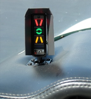
    Where does this get dangerous?  High elevation airports.  Whenever the OAT creeps above 85 or 90 at an airport that is higher elevation (I would classify higher elevation as 2,500 feet or higher), the corresponding density altitude sky rockets.  If a pilot isn’t paying attention to airspeed or angle of attack (if the airplane is equipped with an AOA), a stall can come very quickly on climb out.

    What to take home from this?  Monitor your climb speed and angle of attack, especially right after takeoff, when you hear density altitude on the ATIS or AWOS.

  • Avidyne Entegra Chart Updates

    Columbia 400 Avidyne Entegra

    There are a number of airplanes out there equipped with the Avidyne Entegra PFD and MFD system, most notably the Cirrus SR20 and SR22 models from the early 2000s and the Columbia 350 and 400 from the same era.  The Entegra is pretty simple and easy to learn, but doesn’t have the capability that it’s Garmin glass panel counterparts do (I have not, however, tried the R9, which could prove much more capable than it’s predecessor).  I have found that pilots master the Entegra a lot quicker because of the reduced functionality.

    One of the nice features of the Avidyne Entegra is the CMAX Chartview option.  With a yearly subscription, you can get all the Jeppesen approach plates and airport diagrams for the entire US on your MFD.  Just like your GPS, though, you have to update the charts monthly to keep them legal.  After a period of time when you don’t keep up with the updates (I believe it is 90 days), then the charts disappear.

    The update process is a little tricky if you don’t have someone to explain it to you.  Once you go through it a few times, you’ll have it down pat.  Here’s the process for the Avidyne Entegra Chart Updates.

    Jeppesen Subscription

    The first step in performing your Avidyne Entegra Chart Updates is to create an account with Jeppesen, who handles all the GPS NavData and MFD Chart updates for both Garmin and Avidyne.  If you already have a Jeppesen subscription, you can skip down to the next section.  To do that, simply go to jeppdirect.jeppesen.com, and then do the following:

    • Click on Avionics Data on the upper left hand side
    • Click “Purchase Avionics Subscription”
    • Then, click on “Create Account” in the new users section
    • Once you’ve created an account, login, then put in your aircraft information and select 1 update for the Avidyne Entegra EX500 EX 5000
    • Click Continue at the bottom and you can put in your payment information

    Software Needed

    There are two different programs depending on if you have a PC or a Mac.  If you have a PC, you need the Jeppesen Services Update Manager (JSUM).  If you have a Mac, you need the Jeppesen Distribution Manager (JDM).  Download whichever one you need, then login, and your updates will show up.

    Downloading the Avidyne Entegra Chart Updates

    First, we’ll go through the process of performing the Avidyne Entegra Chart Updates process for a Windows computer, using JSUM.    You’ll need two 2 GB USB drives formatted to FAT 16.  Here’s how to format to FAT 16.

    • Go to My Computer after inserting the USB drive
    • Right click on the drive
    • Click on Format, then select FAT and press OK

    Once the USB drive is formatted to FAT16, open up the JSUM program.  Login and your updates will be displayed on the screen

    • You’ll need to set the Avidyne CMAX Key Code
      • Right click the Avidyne Electronic Charts Service and click Set Avidyne Key
      • To get the key code, visit MyAvidyne.com and create an account using your JeppView subscription number and your serial number for your Avidyne MFD (found on the AUX page) and your PFD serial number (displayed on startup when the PFD is warming up)
      • Once you get the Key Code, copy and paste it in the window and click OK
    • Click on the service and click Start
    • The program should automatically detect the drive (if it doesn’t, click browse and select the drive)
    • Click Continue and the charts will start downloading and automatically programmed to the USB drive
    • If you are updating NavData on the MFD as well, follow the same steps as listed above in order to update the NavData

    Next, we’ll go through the Avidyne Entegra Chart Updates process on a Mac, using the JDM program.  You’ll need two 2 GB USB flash drives formatted to FAT 16 (the easiest way to format to FAT 16 is on a Windows computer, using the process above).

    • Open the JDM program and login
    • Insert the first USB drive
    • You’ll need to set your Avidyne CMAX Key Code
      • Click Service Details under the Electronic Charts Service
      • Click Set Avidyne CMAX Key Code
      • Program automatically detects the USB drive
    • Click and drag the Electronic Charts service over to the USB and release
    • The service is downloaded and copied to the USB drive automatically
    • Eject the USB drive
    • Insert the second USB drive (or plug the USB drive in to your MFD, do the update, then reformat the drive) and follow the same steps for the NavData

    Updated the MFD with the Avidyne Entegra Chart Updates

    Avidyne Cirrus

    Once everything is programmed the your USB drives, the rest of the process is simple.  Just go out to your airplane, plug in the first USB drive with the Electronic Charts on it, turn your battery on and the avionics master, and the system will upload the information automatically.  Once it’s finished, turn everything off, pull the USB drive out, then insert the second USB drive and do the same thing.

    Now, you’re all updated!

    If you’d like to see a video on the process, Jeppesen has some very good videos on the updating procedure.  The links are below.  If you have questions, please contact Texas Top Aviation and an expert will help you through the process.

    JSUM USB Programming Procedure

    JDM USB Programming Procedure

    Avidyne Entegra Chart Updates Upload

Leave a Reply

Your email address will not be published. Required fields are marked *