Are you ready to take part in one of the most exciting Texas aviation events of the year? Registration is now open for the 2025 Texas Top Aviation Fly-In, happening March 26th-28th, 2025, at the stunning Lajitas Golf Resort in Lajitas, Texas.
Whether you’re a pilot looking for a getaway, wanting to make new pilot buddies, or just seeking a one-of-a-kind adventure, the 2025 Texas Top Aviation Fly-In promises an unparalleled blend of community, aviation instruction, and scenic Big Bend recreation. Not to mention, great golf!
Why You Should Register
As one of the top 2025 Texas aviation events, this Fly-In features:
Two rounds of golf at the #1-ranked Black Jack’s Crossing Golf Course
Aviation seminars from industry leaders
Making new friends and seeing old ones at our group dinners
Non-golfing activities, like Jeep rentals, exploring Big Bend, or relaxing at the Resort spa
Spaces are limited, so secure your spot now for our 6th Annual Fly-In!
Event Highlights
Fly-In Golf Tournament
Enjoy two rounds of golf at Black Jack’s Crossing Golf Course:
Round 1: March 26th, 2025, 1:30 PM
Round 2: March 27th, 2025, 1:30 PM
Aviation Seminars
Learn from top experts on Thursday morning, March 27th, 2025:
Paul New: Cirrus and Cessna mechanic
Scott Williams: Aviation attorney
Travis Ulhorn: San Antonio Air Traffic Controller
Community and Connection
Relax and connect at evening group dinners starting at 7:30 PM.
Pricing
$1,475 per person (2 nights + golf) + tax
$1,100 per person (2 nights, no golf) + tax
$475 for non-golfing spouse + tax
Registration includes lodging and golf; food and beverages will be billed directly to the attendee.
Key Details
Golfers: Arrive by noon, March 26th, 2025
Non-Golfers: Arrive by dinner on March 26th
Complimentary shuttles provided from Lajitas International Airport (T89)
Register Today
Don’t miss out on one of the best Texas aviation events of the year. Register now and be part of the 2025 Texas Top Aviation Fly-In. Spaces are limited, so don’t wait!
The Cirrus Pilot Proficiency Program is coming back to the Lone Star Airport in Conroe, TX (KCXO) on October 23rd-25th. Wondering what the CPPP program is?
“CPPP offers a weekend event for Cirrus owners and their partners that focuses on Cirrus-specific knowledge and flying proficiency. We bring some of the most experienced flight instructors who regularly teach in all kinds of Cirrus airplanes flown for all kinds of missions. We have prepared an extensive syllabus of ground courses that complement the transition training and delve into areas of greatest need for Cirrus pilots.” (from CirrusPilots.org)
The weekend starts off with a group dinner on Friday night. The Saturday morning ground session focuses on General Aviation Safety with special focus on the Cirrus accident statistics. Normal and emergency procedures are also reviewed.
In the afternoon on Saturday, the attendees are split into two groups. The first group has a myriad of options for ground sessions covering all topics related to Cirrus aircraft and operations. The second group flies, then they switch for the second 3 hour session. Sunday brings the same split, with more courses offered and more flying.
While the Cirrus pilots are flying and learning more about their airplanes, CPPP offers a Partner in Command course for flying partners on Saturday. This allows flying partners to be more comfortable in the airplane and teaches them what to do if something were to happen to the pilot.
All in all, attending a CPPP will improve both Cirrus knowledge and Cirrus flying skills. It’s highly recommended for all Cirrus pilots.
To register for the CPPP event in Conroe, check out the CPPP website.
The first task I give my new instrument students before we start training is to find a view limiting device that they like. There’s the hood that everyone hates (which has been used since the beginning of instrument training,though it isn’t that uncomfortable) or foggles, which usually end up becoming very uncomfortable very quickly. The headset ends up pressing the sides of the foggles into the side of your head, leaving lumps and scars that hurt for days.
Well, there is finally another solution that combines the hood and foggles. Meet the ViBAN.
ViBAN brags that it is the most comfortable IFR view limiting device out there. I have a customer who has one and he loves it. It’s easy to put reading glasses on underneath while still blocking the view of the exterior of the plane. It doesn’t leave bruises against the side of your head, either.
If you’re looking for something different for your IFR training, give ViBAN a try.
When cleaning airplanes, the majority of people don’t know how to properly maintain their TKS panels. TKS panels provide wing leading edge, horizontal stabilizer leading edge, and, in the case of FIKI airplanes, vertical stabilizer leading edge de-icing protection. For those not familiar with them, they are metal strips that have thousands of holes drilled into them where the TKS fluid seeps out. They have become quite prevalent on Cirrus aircraft, the Cessna TTx, and Mooney aircraft manufactured in the last decade or so. The system is also known as a weeping wing system.
Being on the leading edges, these panels pick up bugs very easily. For the uninitiated, it would make sense to just use normal airplane cleaner to spray the panels and scrub the bugs. Don’t!
Using anything that contains Methyl Ethyl Ketone (MEK) as that can harm the TKS bladders behind the panels. Any aircraft cleaner containing wax could cause the pores to clog, preventing the TKS fluid from properly seeping onto the wing.
What’s the best thing to do? Soap and water with a soft cloth is a good start (again, make sure it doesn’t have wax in it. Dish soap would be suitable). No hose available? Just simply turn the TKS system on, let it run till you start to see fluid drip off the wings onto the ground, and use the fluid to clean the panels.
A soft cloth would work fine, but, if the panels are really buggy, take a green scouring pad to do some scrubbing. Just make sure the scrubbing motion is up and down with the grain, not side to side. You can find the green scouring sponges on the dishwashing aisle in the grocery store. Just leave one in the hangar for when you need it.
Figuring out the pattern altitude at an airport should be pretty simple, right? But, in this day of helpful technology, most pilots actually get it wrong. How can you always get it right? Well, it just takes about an extra 15 seconds. Here’s how.
John Wayne Airport Traffic Patterns
As outlined in the Aeronautical Information Manual, section 4-3-3, “traffic pattern altitudes for propeller-driven aircraft generally extend from 600 feet to as high as 1,500 feet above the ground.” Further, in the Pilot’s Handbook of Aeronautical Knowledge on page 13-10, it states: “1,000 AGL is recommended pattern altitude unless established otherwise.”
Okay, so for piston driver’s, we’ve got it narrowed down to 1,000 AGL (Above Ground Level for those who don’t like acronyms). But wait! There’s that very important phrase at the end of the last quote: “unless established otherwise.” That means not all airports have traffic pattern altitudes of 1,000 AGL, or else they wouldn’t put that line in there!
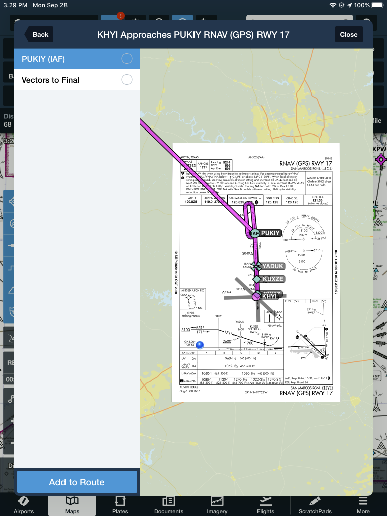
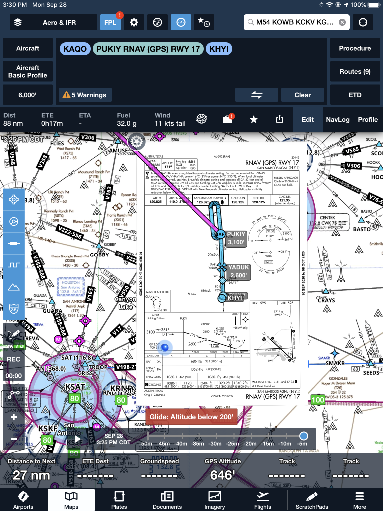
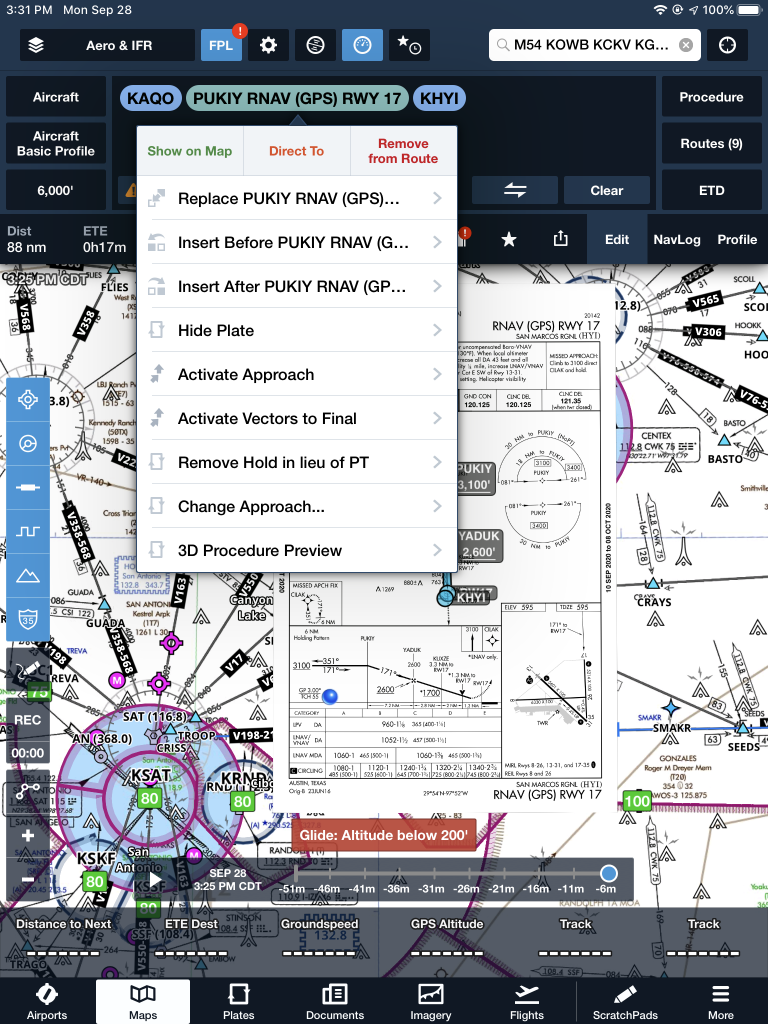
How do you find out what the TPA (Traffic Pattern Altitude) is for a certain airport if it’s not 1,000 AGL? Great question! Your first guess is probably to look on Foreflight. Though this is a good start, it is not the full answer.
Let’s use an example. Look up KAQO, the Llano Airport on Foreflight. At the top of the page, the airport elevation is stated as 1,101′ MSL and the pattern altitude is stated as 1,902′ MSL. From what we just learned, 1,902′ MSL is not 1,000 AGL, so is 1,902′ MSL otherwise established?
On the Airports page with KAQO pulled up, tap the A/FD tab, second to last on the left. Scroll down to Llano Muni. Read the whole entry. Does it state in the entry that pattern altitude is different than 1,000 AGL? It sure doesn’t. So, because it is not otherwise established, pattern altitude at KAQO is 2,102′ MSL not 1,902′ MSL.
Where did Foreflight get that? I have no idea. Too often, though, pilots look at the Foreflight pattern altitude and don’t actually check the Airport Facilities Directory (A/FD). Then, they get the pattern altitude wrong.
What does it look like when pattern altitude is otherwise established? Look up KSGR, Sugar Land Regional, on your Foreflight app. Foreflight states the elevation as 82′ MSL and the Pattern Altitude as 1,000′ MSL. Is this correct? Well, tap that A/FD button again and let’s find out.
On the second line of the A/FD entry, it says TPA-See Remarks. Down in the remarks section, we find the following:
TPA-1000 (918) single engine piston acft, TPA-1500 (1418) for twin and turbojet acft, TPA-500 (418) for helicopters within 2NM.
Foreflight got it right this time for single engine pistons, but if you are in a twin, the pattern altitude is different. What’s the lesson here? Always check the A/FD and don’t always go by what Foreflight says. The A/FD is always right and usually has a little more detail to help set you straight.
One last thing. Both the AIM and the Pilot’s Handbook of Aeronautical Knowledge, when talking about pattern altitude, state, “When operating at an airport, traffic pattern altitudes should be maintained unless otherwise required by the applicable distance from cloud criteria in…section 91.155.” 91.155 defines basic VFR weather minimums. So, to fully interpret what the AIM is saying, we have to take into account the type of airspace we are in to determine if we can safely and legally operate at pattern altitude at a particular airport.
For example, let’s say we are at KCVB, the Castroville Airport. Pattern altitude there is 1,602 feet, which is 829 AGL. CVB is Class G airspace up to 700 AGL, then Class E above that. Let’s say there is a 700 AGL broken cloud layer. Pattern altitude is 829 AGL, so you won’t be able to get up that high with a broken ceiling. What altitude can you do pattern work at to stay legal?
Class G VFR weather minimums during the day below 1,200 AGL is 1 SM visibility and clear of clouds. So, legally, you could fly at 699 AGL (which at CVB would be 1,472 MSL) while in the pattern and be legal. Safe? Maybe, but probably not if you are skimming the base of the clouds. Is 1300 MSL a safer pattern altitude in this example? Well, that is 527 AGL, so probably not, since towers tend to stick up that high sometimes.
Let’s go back to KSGR and put a 1,000 AGL overcast ceiling there. SGR is Class D airspace and we already determined pattern altitude there was 1,000 MSL for piston singles. VFR visibility and cloud clearance requirements in Class D airspace are 1,000 feet above clouds, 500 feet below clouds, and 2,000 feet horizontally from the clouds with 3 SM visibility. In order to stay 500 feet below the clouds, you would be flying a 582 MSL pattern. Safe? Probably not, though it is legal.
To summarize, don’t take Foreflight’s word for pattern altitude. Cross reference the A/FD (it only takes 15 seconds at the most) to verify. If it’s cloudy, it’s really best to stay on the ground, but if you want to find out your legal pattern altitude with a cloud deck, cross reference 91.155. I don’t recommend flying below pattern altitude because it is there for a reason.
Two pilots walk into an FBO. “Nice airplane,” Pilot 1 says to Pilot 2. “What kind of panel do you have in it?”
“I just went all glass,” Pilot 2 says. “Put in the Garmin G500 TXi, a GTN 750, and upgraded to the GFC 600 Autopilot. Even put in the Mid-Continent standby instruments. It’s a pretty sweet set up. What about you?”
“Wow, sounds like it!” Pilot 1 responds. “I went a different route. I liked all my old BendixKing instruments, so I stuck with the company. I put in a BendixKing AeroVue Touch panel, a BendixKing KSN 770 touch screen GPS, kept my KFC 225 autopilot, got the ADS-B out compliant BendixKing KT 74 transponder, and finished it off with a King AeroFlight KI 300 Digital Backup instrument.”
Wait, what? BendixKing?
Yes, my friends, BendixKing is still around.
We are all used to the latest and greatest Garmin products these days. Don’t get me wrong, Garmin and Aspen make great retro-fit products for your instrument panel, while Garmin and Avidyne are at the top of the touch-screen GPS market, but don’t forget about BendixKing. They are staying in the game too.
BendixKing announced in April the xVue Touch for experimental aircraft, with the STC for the AeroVue Touch for certified aircraft coming later this summer. The xVue and AeroVue touch are pretty nifty units, comparable in features to what Garmin is doing with the G500 TXi and G600 TXi. It will be difficult to claw back into a competitive market share with Garmin, but BendixKing might find a niche market of followers.
Let’s take a look at the unit.
BendixKing AeroVue Touch
Now, I have not used the BendixKing AeroVue Touch or the xVue Touch, only read about them. But, what I’ve read sounds pretty cool. The display has really good resolution (BendixKing brags it is the highest screen resolution available), synthetic vision that comes standard (Garmin & Aspen charge extra for synthetic vision), plus VFR Sectional Charts & IFR High and Low Enroute charts, making paper charts even more obsolete.
The display is 10.1 inches and can be easily swapped between a full screen instrument mode or a split screen setup as seen above. Apparently, BendixKing has 3-D moving maps available on the AeroVue Touch too, which is standard.
The one thing Garmin has on the BendixKing AeroVue Touch right now is engine information. The G500TXi has a full complement of engine gauges available; the AeroVue Touch doesn’t, yet. BendixKing says it’s in the works, as well as radio information and autopilot control. I’m assuming the future autopilot control software would mean you could remotely mount an autopilot controller and input all functions from the AeroVue Touch display. The nice thing about these future upgrades is all the software updates are free through BendixKing.
The sticker price for the forthcoming unit is going to be about $12,600. Garmin’s 10.5 inch G500 TXi is $16,000, while Aspen doesn’t offer anything quite that big.
BendixKing KSN 770
I’ve been keeping my eye on the BendixKing KSN 770 Touchscreen WAAS GPS for a few years now. It never really has caught on quite like the Garmin GTN 750 or the Avidyne IFD 540. BendixKing took the same route that Avidyne did in creating a hybrid touch GPS (or mini-MFD if you want to look at it that way) where a pilot can perform functions either using the touch screen or utilizing soft keys on the edges. I like the hybrid touch approach as I have been bounced around in turbulence while trying to tap something into a Garmin GTN 750 and it can prove difficult.
Similar to the AeroVue Touch, BendixKing utilized split screen technology in the KSN 770. It’s a full WAAS unit that is already certified. It’s sticker price is $14,200, compared to the Garmin GTN 750 at $17,200 and the Avidyne IFD 540 at $15,000.
Other BendixKing Gadgets
Here are some other BendixKing Gadgets both available now and in the works:
KFC 230 AeroCruz Touchscreen Digital Autopilot-2 or 3 axis options. Will be the only touchscreen digital autopilot available on the market. Also able to utilize the servos from older KFC autopilots. Should be available late fall or winter ’18.
For those of you who frequent the Houston area, make sure to check your NOTAMs. The Houston Executive Airport (KTME) in Katy recently opened a control tower. The Houston Executive tower information won’t show up on the sectional chart till the new chart comes out in the spring. The only way to get the information about the tower and the airspace will be via NOTAMs or when the new Airport/Facilities Directory comes out on November 3rd. The tower opened October 1st.
According to AOPA, the airspace will remain Class G around the airport, even though there is a control tower in place. Since the Houston Executive tower is there, it will be mandatory to contact the tower when passing through the airspace. KTME’s airspace stretches up to 2,000 feet MSL and goes out to a 4 sm radius around the airport. It is a VFR Only tower, so the controllers do not have radar.
The tower is open from 6am-10pm, local time, 7 days a week.