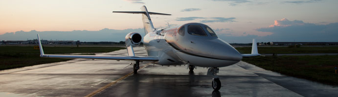
We have all been hearing about the HondaJet for quite a while now. It’s been in testing for a number of years, but it sounds like certification and deliveries will commence early in 2015. Honda says they expect FAA certification in the first part of 2015 and deliveries will commence soon thereafter.
For those of you in the San Antonio area, if you’d like to get a glimpse of the first production HondaJet, it will be at Landmark Aviation at KSAT on Wednesday, October 29th. Cutter Aviation is hosting the event, as they will handle the regional sales for Honda. No flights will be conducted, but folks are welcome to walk around the airplane, climb inside, and give it a good once over.
For those planning on attending, RSVP is required. Contact Lisa Harris at Cutter to RSVP either by phone (602-267-4054) or by email (lharris@cutteraviation.com). Drinks and snacks will be served. The event runs from 5:30pm-8:00pm.
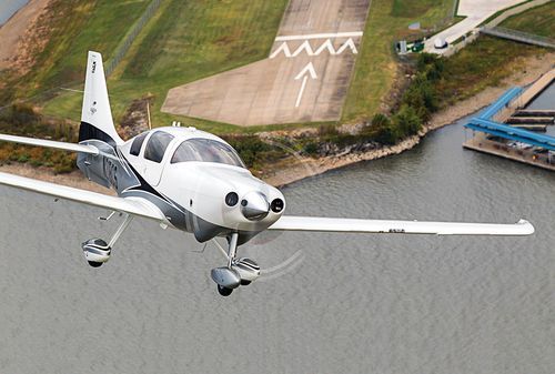
Sadly, in January, a pretty great airplane was put out to pasture. Textron (the conglomerate that now owns Cessna, Beechcraft, Hawker, and Lycoming) announced it was ceasing production of the Cessna TTx. With the end of the Cessna TTx production, an airplane that was the main “competitor” to Cirrus (if you can call it competition; Cirrus consistently outsold the Cessna TTx by a wide margin each year), it leaves the SR series to stand alone atop the High Performance piston single market.
I got to go through Cessna’s FITS Accepted Instructor (CFAI) course back in 2012 and have flown in the Cessna 350 and 400 (which is what they were known as at the time; the Cessna TTx name came around in 2011) for about 120 hours. I really like the airplanes. I’m partial to the Cirrus, but the Cessna 350 & 400 are fast airplanes and great for 1-2 people. I flew a 350 (the non-turbo charged version) from New York to San Antonio last fall and routinely saw 170 knots at 12 GPH.
Columbia started out making the 350 & 400 (the turbo-charged version) in the early 2000s, but went bankrupt in 2007. Lancair started Columbia to make a certified version of their popular kit planes. If you see a Lancair ES floating around, you would swear it’s a Columbia with only 1 door. Cessna bought the design from Columbia in 2007 to begin manufacturing the airplanes themselves.
Cessna then made a huge mistake as they moved the production facility from Bend, Oregon to Mexico. Production completely halted in 2009 as the planes coming out of Mexico were found to have defective composite work. The sales never really recovered, even though Cessna put the Garmin G2000 panel in the Cessna TTx, complete with a touchscreen key pad. A FIKI system was added as an option in 2012.
A prospective buyer can still get a great value on a used 350, 400, or TTx, as they are valued a little lower than a Cirrus. The 350, 400 or TTx all make excellent single pilot or two person speedsters with very comfortable amenities.
The 2022 Fly In Season kicks off March 4th-5th with the US Aircraft Expo at the Addison, TX Airport (KADS). Cutter Aviation at KADS will be the host for the event. All the major and minor aviation manufacturers will have static aircraft displays. Come see all the new Cirrus innovations, the Piper M600, and the Diamond DA62. All the latest and greatest technology will be available for your viewing enjoyment.
If you are planning on flying in, the FBOs at ADS are Million Air and Atlantic.
The event will run from 10am-3pm on both days, March 4th and March 5th.
Figuring out the pattern altitude at an airport should be pretty simple, right? But, in this day of helpful technology, most pilots actually get it wrong. How can you always get it right? Well, it just takes about an extra 15 seconds. Here’s how.
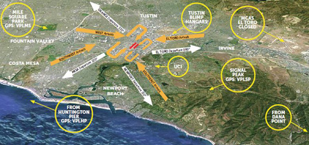
John Wayne Airport Traffic Patterns
As outlined in the Aeronautical Information Manual, section 4-3-3, “traffic pattern altitudes for propeller-driven aircraft generally extend from 600 feet to as high as 1,500 feet above the ground.” Further, in the Pilot’s Handbook of Aeronautical Knowledge on page 13-10, it states: “1,000 AGL is recommended pattern altitude unless established otherwise.”
Okay, so for piston driver’s, we’ve got it narrowed down to 1,000 AGL (Above Ground Level for those who don’t like acronyms). But wait! There’s that very important phrase at the end of the last quote: “unless established otherwise.” That means not all airports have traffic pattern altitudes of 1,000 AGL, or else they wouldn’t put that line in there!
How do you find out what the TPA (Traffic Pattern Altitude) is for a certain airport if it’s not 1,000 AGL? Great question! Your first guess is probably to look on Foreflight. Though this is a good start, it is not the full answer.
Let’s use an example. Look up KAQO, the Llano Airport on Foreflight. At the top of the page, the airport elevation is stated as 1,101′ MSL and the pattern altitude is stated as 1,902′ MSL. From what we just learned, 1,902′ MSL is not 1,000 AGL, so is 1,902′ MSL otherwise established?
On the Airports page with KAQO pulled up, tap the A/FD tab, second to last on the left. Scroll down to Llano Muni. Read the whole entry. Does it state in the entry that pattern altitude is different than 1,000 AGL? It sure doesn’t. So, because it is not otherwise established, pattern altitude at KAQO is 2,102′ MSL not 1,902′ MSL.
Where did Foreflight get that? I have no idea. Too often, though, pilots look at the Foreflight pattern altitude and don’t actually check the Airport Facilities Directory (A/FD). Then, they get the pattern altitude wrong.
What does it look like when pattern altitude is otherwise established? Look up KSGR, Sugar Land Regional, on your Foreflight app. Foreflight states the elevation as 82′ MSL and the Pattern Altitude as 1,000′ MSL. Is this correct? Well, tap that A/FD button again and let’s find out.
On the second line of the A/FD entry, it says TPA-See Remarks. Down in the remarks section, we find the following:
TPA-1000 (918) single engine piston acft, TPA-1500 (1418) for twin and turbojet acft, TPA-500 (418) for helicopters within 2NM.
Foreflight got it right this time for single engine pistons, but if you are in a twin, the pattern altitude is different. What’s the lesson here? Always check the A/FD and don’t always go by what Foreflight says. The A/FD is always right and usually has a little more detail to help set you straight.
One last thing. Both the AIM and the Pilot’s Handbook of Aeronautical Knowledge, when talking about pattern altitude, state, “When operating at an airport, traffic pattern altitudes should be maintained unless otherwise required by the applicable distance from cloud criteria in…section 91.155.” 91.155 defines basic VFR weather minimums. So, to fully interpret what the AIM is saying, we have to take into account the type of airspace we are in to determine if we can safely and legally operate at pattern altitude at a particular airport.
For example, let’s say we are at KCVB, the Castroville Airport. Pattern altitude there is 1,602 feet, which is 829 AGL. CVB is Class G airspace up to 700 AGL, then Class E above that. Let’s say there is a 700 AGL broken cloud layer. Pattern altitude is 829 AGL, so you won’t be able to get up that high with a broken ceiling. What altitude can you do pattern work at to stay legal?
Class G VFR weather minimums during the day below 1,200 AGL is 1 SM visibility and clear of clouds. So, legally, you could fly at 699 AGL (which at CVB would be 1,472 MSL) while in the pattern and be legal. Safe? Maybe, but probably not if you are skimming the base of the clouds. Is 1300 MSL a safer pattern altitude in this example? Well, that is 527 AGL, so probably not, since towers tend to stick up that high sometimes.
Let’s go back to KSGR and put a 1,000 AGL overcast ceiling there. SGR is Class D airspace and we already determined pattern altitude there was 1,000 MSL for piston singles. VFR visibility and cloud clearance requirements in Class D airspace are 1,000 feet above clouds, 500 feet below clouds, and 2,000 feet horizontally from the clouds with 3 SM visibility. In order to stay 500 feet below the clouds, you would be flying a 582 MSL pattern. Safe? Probably not, though it is legal.
To summarize, don’t take Foreflight’s word for pattern altitude. Cross reference the A/FD (it only takes 15 seconds at the most) to verify. If it’s cloudy, it’s really best to stay on the ground, but if you want to find out your legal pattern altitude with a cloud deck, cross reference 91.155. I don’t recommend flying below pattern altitude because it is there for a reason.
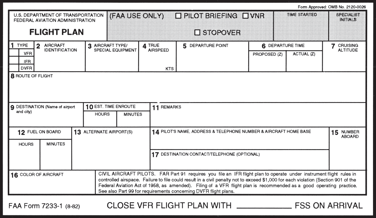
Raise your hand if, after you have officially become a pilot by passing your private pilot check ride, you consistently file VFR flight plans with Flight Service.
Anybody?
Okay, let’s revise the question. Raise your hand if you have filed VFR flight plans at least 5 times in the last year.
Okay, one or two hands go up.
That’s it?
To be perfectly honest, I have filed VFR Flight Plans twice (I think) in the last year. The only reason I did was because I was flying in an area that had poor radar/radio communications and I wanted someone to know where I was (I was ferrying an airplane through southern Oregon and northern Nevada which is mountainous and is hard to get coverage into at lower altitudes). I was so unaccustomed to doing it that I nearly forgot to call and close my flight plan.
This is a common complaint amongst pilots concerning VFR flight plans. It’s extremely easy to get to your destination, hop in the car and completely forget to close your VFR flight plans. Thankfully, now a days, the Flight Service Station will typically call the number you put in your VFR flight plans (your cell phone number most of the time) to make sure you are on the ground before initiating search and rescue services.
Another complaint is that it is cumbersome to call the Flight Service Station after departing to open the VFR flight plans. This is especially true in a busy airspace area or if the pilot is getting a VFR Flight Following and talking to ATC on a different frequency.
I still think it is a great idea to file and utilize VFR flight plans. If you don’t show up at your destination, someone will come looking for you which could mean the difference between getting stranded after an off airport landing and getting a warm cup of coffee at the end of the day. Even if the you get flight following from ATC, it’s still good to file a flight plan.
Lockheed Martin, who runs all the Flight Service Stations across the US, heard these complaints from pilots and decided to come into the modern age and make it easier to open and close flight plans. They developed EasyActivate and EasyClose.
File your VFR flight plans first, through calling the FSS or on your favorite iPad app. Then, for EasyActivate, you’ll receive an email 30 minutes prior to your ETD with a link in it. Simply click/tap on the link and your flight plan is activated. No having to call FSS in the air, no having to try to get them on the ground. Just tap the link and you’re good to go.
For EasyClose, you’ll receive an email 30 minutes prior to your ETA at your destination. When you get on the ground, you’ll see the email in your phone or iPad and you just tap the link and your flight plan is closed. Since we all have our phones and iPads with us constantly, there will be no more forgetting to close the flight plan and getting that angry call from the FSS.
Sign up is quick and easy. All Lockheed Martin needs is your email address, last name and phone number. They’ll send you the password to set up your account. Log in (they will have you change your password immediately), then just click on EasyActivate/EasyClose up at the top. You have to register the email address you want (you can also put in a phone number to receive a text message, and you can put multiple email addresses and phone numbers if you’d like), then you are all set to go.
What’s the most cost effective glass panel retrofit? There are several options out there (and it seems like more coming each Sun ‘N’ Fun or Osh Kosh event), but the consensus is the Aspen EFD 1000 or 1500, right? At $12,000 installed, it’s about $8,000-$10,000 cheaper than the Garmin G500 (though you can make the argument that when you add a second screen and SVT to the Aspen, the price is about the same).
I am here to blow your mind. What if you could get a glass panel retrofit that is a complete AHRS system with airspeed and altitude, plus a slaved HSI that auto slews to your GPS and a 4 hour backup battery so you can throw your steam attitude indicator away, for only $4,600, plus installation?
I am not crazy.
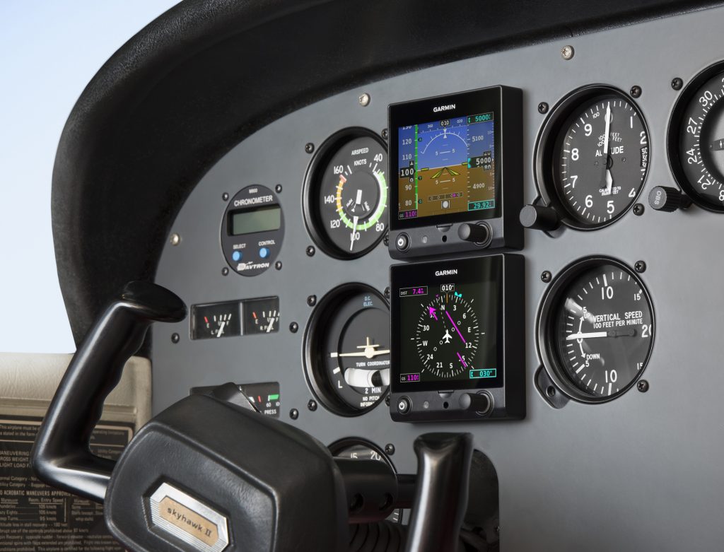
The Garmin G5 debuted last year when the FAA relaxed it’s regulations to allow more experimental avionics into certified airplanes. The single G5 was a big hit. The 3.5 inch screen fit nicely into the hole that the traditional attitude indicator left, giving pilots a glass attitude, airspeed and altimeter options for less than $2,500.
In March, Garmin brought out the HSI version of the G5. Equipped with a low cost magnetometer, the DG/HSI version is a complete replacement for the traditional DG/HSI. The unit also displays ground speed and distance (received from the GPS information), while auto-slewing to the GPS flight plan, so the CDI needle will move on it’s own, eliminating the annoying need for the pilot to set the course on the HSI (and ridding the GPS of the message that pops up reminding the pilot to set the course).
The dual units provide a complete backup Attitude in the case of a display failure. The reversionary mode you get with the Garmin G1000 and the Garmin G500 is also present in the dual G5s. This eliminates the need for a backup steam gauge attitude indicator, freeing up panel space for an engine monitor or some other toy. The G5 units can also be equipped with 4 hour backup batteries in case of electrical failure.
The price for the dual G5 setup is very reasonable at just under $4,600 plus installation (which, according to Garmin, should be pretty simple as the units act as plug and play instruments). The AHRS unit is available stand alone for under $2,200 while the DG/HSI unit standalone runs just under $2,600.
This is the second part in a series on drones and Unmammed Aerial Systems (UAS). To read Part 1, Drones: A Brief History, please click here.
I’m surprised how often I’ve been asked about drones by concerned passengers as they load up for a charter flight. Most commonly I’m asked how many drones I’ve seen while I’m flying, or how many drones I’ve hit/ almost hit. Sadly, the media has made this drone crisis into something that it isn’t. I’ve never seen a drone while I was operating a full scale aircraft, and I’ve certainly never been put into a situation where I felt that a drone was a threat to my safety or the safety of the flight. In fact, I only personally know one pilot who has reportedly seen one around an airport and that was an isolated incident (and a non-event).
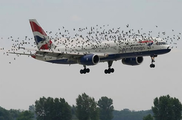
The reality is that while Unmanned Aerial Vehicles can be a real danger to full scale aircraft, incidents aren’t actually all that common and detailed information is often lacking or missing altogether. It is likely that some of the reported drone incidents were actually a case of a pilot confusing a loose balloon or a bird for a drone. This, combined with the media’s sensationalizing of every “close” encounter nationwide has led the public to believe that the problem is much bigger than it actually is.
In actuality, when the AMA (Academy of Model Aeronautics, the USA’s governing body for model aircraft) analyzed the data from the FAA’s 764 recorded Drone sightings, only 27 of them (3.5%) were actually recorded as “near misses” or “near collisions.” Additionally, only 10 of the records (1.3%) indicate that pilot was required to take evasive action.
The records also include reports of drone sightings at altitudes which would be impossible for civilian models to attain (19,000-24,000′). Finally, some of the sightings took place in areas which are specifically set aside for model aircraft and drones to operate. In those cases, the person flying the drone when it was reported was actually doing so in a safe and legal manner in an area designated for that specific purpose. If you’re interested, the whole article is available here and has a lot of great information.
As pilots, it is important that we do our part in helping reduce the risk of drone strikes. The biggest thing that we can do to help is to report any activity that we see so that it can be investigated and hopefully the drone operator can be found and dealt with. Try to get as much detail as possible about the incident, such as the size, color, location, direction and altitude of any sighted UAVs and report it to the closest tower or controlling agency.
Recently, the people in Washington have come up with a bunch of new rules to regulate the operation of model aircraft. As of this year, every unmanned aerial vehicle between 0.5 and 55 lbs must be registered with the FAA and have an FAA issued registration number located on the model itself. The logic here is that if someone crashes a drone where it shouldn’t have been operated, the officials will be able to identify the owner of the model and take action.
Model manufacturers and vendors have also agreed to start providing information about a program called “Know Before You Fly” (KBYF) in the packaging of the drones. This program seeks to help educate new hobbyists to the rules and responsibilities associated with model aviation. For more information on KBYF, here is a link to their website.
In the end, the sad reality is that it’s a combination of many factors: new technology making models cheaper and easier to fly, GPS navigation and automation, the media blowing the incidents out of proportion, and inexperienced and foolish operators which have caused the growing concern and required the FAA’s action. I think that it is important to understand that thousands of people have been flying radio controlled models for many years responsibly and this has never been a problem. The AMA has rules (which are the same ones now adopted by the FAA) regarding flying location, altitudes, speeds, and more which have kept both the modelers on the ground and the pilots in the air safe until now. Its a classic case of a few foolish individuals who have caused all modelers to be cast in a bad light.
There is no reason to fly in fear, though. A pilot should always be watching for hazards as he or she is flying, regardless of the variety. In fact, according to the FAA’s website, there were 142,000 wild life STRIKES with civil aircraft in the USA between 1990 and 2013. That seems like a much bigger concern to me than the 764 reported drone SIGHTINGS. As with any new technology, drones are suffering from growing pains. As the rules fall into place and new operators become better experienced, hopefully we will hear about fewer incidents on the evening news. Anyway, I’ll stop “droning” on. Fly safe.
Andrew Robinson is a 135 Charter Pilot and flight instructor who lives with his wife and 2 daughters in Pennsylvania. He flies Pilatus PC-12s and instructs in Beechcraft Bonanzas.