Flying a missed approach can be stressful enough. When you haven’t done one in a while and your GPS isn’t showing you how to get to the missed approach point and you can’t remember which button to press, that adds a lot more stress. Recipe for disaster? Quite possibly!
No need to fear, we are here to help. The procedure for getting a Garmin 530 or 430 to give you missed approach guidance is actually simple and straightforward, if you know what to do!
Note:Because of the variety of different autopilot configurations in different airplanes, this article will focus solely on the GPS.
What the GPS is Thinking
The way Garmin designed the Garmin 530 and Garmin 430 is to be as helpful to pilots as possible. Their thinking was, 95% of the time, a pilot will make a landing on an instrument approach. This is pretty accurate as most of the time, this is what happens. Most general aviation pilots don’t fly approaches to minimums all that often, thus negating the need for a missed approach.
Garmin designed their software with this in mind. When an airplane crosses the missed approach point, the GPS will go into what’s called suspend mode (a SUSP annunciation appears above the OBS key). It will keep the missed approach point as the active waypoint because it assumes the pilot is going to land.
This can be confusing to pilots. This is what happens when software engineers and pilots come together. Engineers often believe they are smarter than pilots! (See the Airbus fly by wire roll out)
The Procedure
In the case of a missed approach, the button pushing on the GPS is actually relatively simple. There is no SUSP key to take the GPS out of SUSP mode (thanks Garmin!). Instead, you press the OBS key. This will take the GPS out of SUSP mode, making the first waypoint on the missed approach procedure the active waypoint. Your GPS will now give you guidance on the missed approach procedure.
If you are going missed off an ILS, LOC, or VOR approach, then there is one more key you’ll have to press. Your CDI needle (whether it is digital or analog, an HSI or just a CDI gauge) will be reading off the NAV radio and your CDI indication on the GPS will be VLOC. After you press the OBS key, press the CDI key on the GPS so you will start getting course guidance from the GPS again.
That’s it. Button pressing on the different autopilots will vary, but if you are familiar with yours, you’ll be able to tell it to follow the GPS and climb to the proper altitude.
It’s winter time, so that means winter weather for the aviation community. For single engine piston pilots, that means dealing with icing conditions. For us Texan flyers, ice only presents an issue for maybe a week out of the year (the exception being for those Panhandle residents!), but it’s nice to have some protection.
Most single engine pistons do not come with ice protection from the factory and, of those that do, most are not Flight Into Known Icing (FIKI) approved. The systems are “get out of jail” systems that can reduce the amount of ice you pick up if you accidentally get into icing conditions and you are on your way out. The Cirrus SR22 line of aircraft has had the TKS system option since 2006, with the new FIKI system being available since 2010. The Cessna TTx has a FIKI option that was debuted in 2014.
The above mentioned airplanes use TKS systems. There are a handful of single engine pistons that use boots that are FIKI certified: the Piper PA46 line (Malibu, Mirage, and Matrix) and the Cessna P210 and T210 line (though not all are equipped with boots).
If you find yourself flying into wintry conditions often and want some protection for your clean wing airplane, there are some aftermarket options for a lot of airplanes now. Do note that all these systems do come with a pretty hefty price tag, but can be worth it if you fly into icing a good bit.
CAV Ice Protection TKS Systems
CAV Ice Protection is a TKS system outfitter. What is TKS fluid? According to Flying Magazine:
“TKS systems dispense an ethylene glycol-based fluid with a freezing point below minus 70 degrees F through porous titanium panels attached to the leading edge of the wing and empennage. The fluid is released through thousands of the panels’ laser-drilled holes, which are not much larger than the size of a human hair. As air flows over the wing and empennage, it disperses the fluid, coating the surfaces, and preventing the formation and adherence of ice.”
The advantages of a TKS system are the whole entire wing gets coated to get rid of any extra ice that adheres to the top or bottom of the wing surface. The disadvantage is there is only a finite amount of fluid, so when it runs out, you don’t have any more protection. The fluid also adds extra weight agains the useful load of the airplane.
CAV Offers a Basic TKS system for the following single engine piston aircraft:
Beech Bonanza
Cessna 182, 206, 210, 350, & 400
Columbia 350 & 400
Piper PA32
Mooney M20
CAV Offers a full FIKI System for the following single engine piston aircraft:
Ice Shield is another after market de-ice option. Ice Shield makes boots for wing leading edges. The advantage of boots is they activate instantaneously, getting rid of ice where it builds up first, on the wing leading edge. No running out of fluid and only the added weight of the system. Ice Shield also offers heated windscreens for several the Piper Saratoga line and the A36, B36, and G36 Bonanza line.
Ice Shield has boots for the following single engine piston aircraft:
One other company, Kelly Aerospace, makes an electric leading edge de-icer called the ThermaWing for the Cessna/Columbia 350/400 line. You can read a review of the ThermaWing here, or check out Kelly Aerospace’s website.
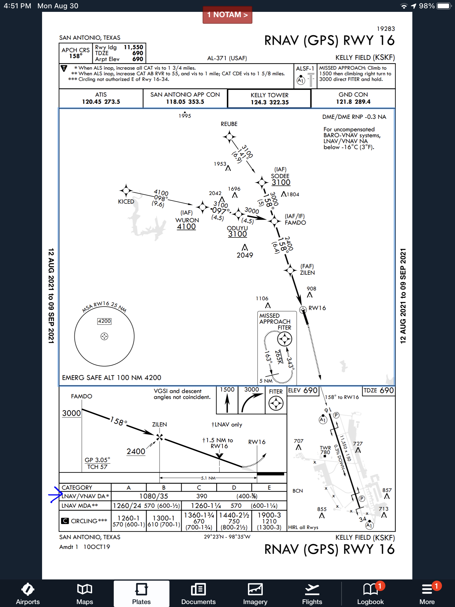
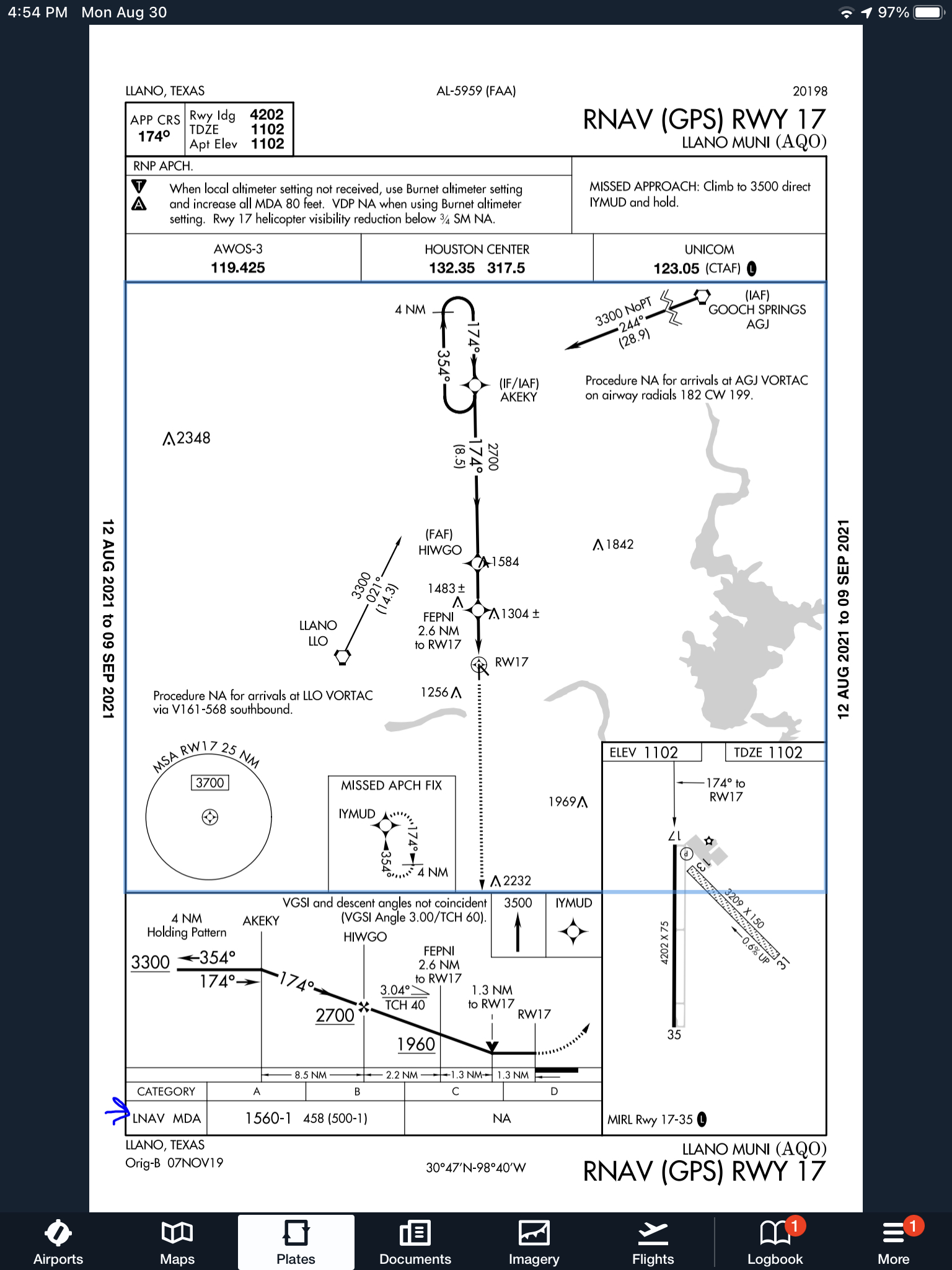
When flying a WAAS GPS approach, there are several different levels of WAAS signal that a GPS receiver can get. The most precise is an LPV signal. LPV stands for Localizer Performance with Vertical guidance. An LPV approach has the lowest minimums of all the WAAS GPS approaches, typically in the range of 200-300 feet AGL. A GPS glide path (GP) is guaranteed with an LPV approach and the minimum altitude is a decision altitude (DA).
Just like a localizer, an LPV course width get’s tighter and the CDI becomes more sensitive the closer the plane get’s to the runway. Even though the LPV approach minimums are so low and the approach is down to a DA, they still aren’t considered precision approaches by the FAA (which leads to some extra planning when selecting an airport as an alternate that only has GPS approaches, since the AIM specifies only the LNAV minimum are to be considered if an alternate airport only has GPS approaches, bringing the 800 foot ceiling requirement to bear)
An LNAV/VNAV approach is still a WAAS approach that has a GPS glidepath, but is slightly different than an LPV approach. An LNAV/VNAV final approach course does not get more sensitive the closer the plane gets to the runway. The smallest course width on an LNAV/VNAV approach is 0.3 miles either side of center. LNAV/VNAV approaches will, most of the time, have higher minimums than LPV approaches and can have minimums no lower than 250′ AGL.
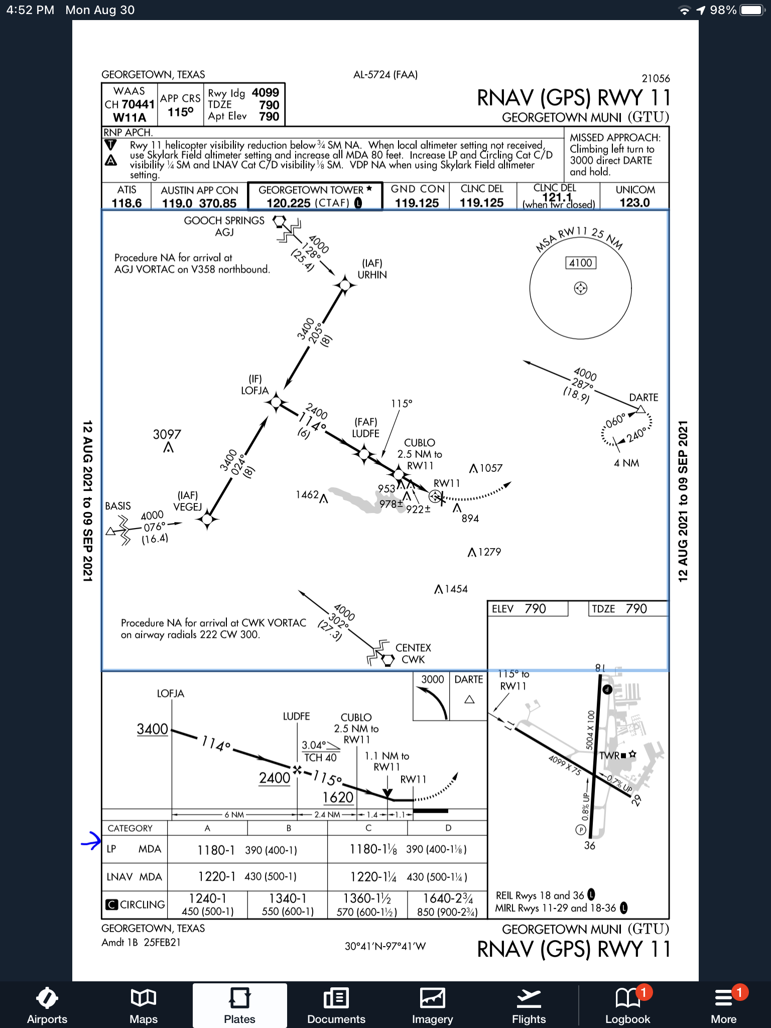
The third type of WAAS approach is strictly a non-precision approach with a Minimum Descent Altitude (MDA). These are designated LP approaches, which stands for Localizer Performance. These are like old school Localizer only approaches that, similar to the lateral portion of an LPV approach, the course width tightens the closer to the runway that a pilot is. There is no glide path by definition of an LP approach, though there is a caveat.
Now, by looking at an approach plate that is a WAAS approach, but only has LP minimums listed, a pilot would assume there would be no glide path. Depending on what type of GPS unit the airplane has, that pilot could be wrong. Garmin Perspective units (Cirrus G1000), all GTN 750s and GTN 650s, All G1000 NXi units, most Garmin 430W and 530W, and all Avidyne IFD 550/540 and 440 units will display an advisory glide path on an LP approach, designated LP+V.
What does LP+V indicate? An advisory glide path is just advisory, but it is totally legal to follow down on a non-precision LP approach. The kicker is obstacle clearance is not guaranteed and the pilot needs to keep an eye on minimum altitudes at the different waypoints on the approach. The big thing I tell people is, when you arrive at the MDA and the runway is in sight, following the advisory glide path below the MDA could get you in trouble with obstacles. Don’t just hone in on your instruments when you break out of the clouds. Look out the windscreen and make sure you won’t hit anything.
If you arrive at the MDA on the advisory glide path and the runway isn’t in sight, DON’T GO BELOW THE MDA! Most autopilots won’t level off at the MDA, even if that altitude is set in the altitude pre-select, so this will involve turning off the autopilot before the MDA and manually leveling off, or engaging the altitude mode of your autopilot at the MDA.
One other type of GPS approach that you will encounter is an LNAV approach. This is a non-WAAS approach down to an MDA, but your GPS unit may still give you a +V. Most modern ones will.
It’s that time of year again! Yes, it’s the New Year, but it’s also time to register for the 2024 Texas Top Aviation Fly In. The Aviator’s Academy’s sister company, Texas Top Aviation, is hosting it’s 4th annual fly in event on March 19th-22nd, 2024 at the Shangri-La Resort in Grand Lake, OK.
For those not familiar with the annual Texas Top Aviation Fly In, we’ve been hosting this event since 2019 and it is always well attended and fills up fast. Geared around aviation education, golf, community, and a whole lot of fun, the fly in is always very popular.
This year, we are adding a Par 3 Shootout for early arrivals on Tuesday, March 19th at the Shangri-La’s Battlefield Par 3 Course. The 4th Annual 2 Round Golf Tournament begins on the afternoon of Wednesday, March 20th and finishes up on the afternoon of Thursday, March 21st.
The biggest hit of the week is always the safety seminars on Thursday morning. This year, Texas Top Aviation has secured the talents of Paul New, expert Cirrus, Columbia, and Cessna mechanic, and owner of Tennessee Aircraft services. If you listen to Mike Busch’s podcast, Paul is a regular. Scott Williams, owner of The General Aviation Law Firm, will be presenting on LLC’s and Illegal Charters, while Hank Gibson, owner of Texas Top Aviation and The Aviator’s Academy, will present a study on several different accidents and what can be learned from other’s mistakes.
It’s guaranteed to be a fun week. The Grove Regional Airport in Grove, OK will be our host airport (KGMJ) this year. Sign up soon as space is limited. Registration is only open till February 23rd, 2024. For more information and to register, simply Click Here. We hope to see you there!
11 years ago, in April of 2009, the Avidyne Corporation unveiled the much bally-hooed Release 9, or R9 as it is commonly known, as a hardware replacement for the Avidyne EX5000 Entegra system in Cirrus Aircraft. The Entegra system was way outdated by that point. Even though Avidyne was the first company to put together a glass PFD in a single engine piston airplane, the company had quickly fallen behind Garmin in keeping up with the ever changing technology landscape.
Rewind to 2008. Cirrus had been going strong with the Avidyne Entegra since the SR20 and SR22 went to full glass in 2003 (a PFD and an MFD; prior to that, Cirrus aircraft only had an MFD with steam gauges and a Sandel Electronic HSI). Cessna, on the other hand, vaulted past the Avidyne Entegra and went straight to the Garmin G1000 in it’s aircraft, starting in 2004 with the 182 G1000 and 2005 with the 172 G1000. Beechcraft and Columbia went to the G1000 (Columbia started with the Avidyne as well) in 2005.
Garmin’s technology in 2007 was so much better than Avidyne’s technology that Cirrus decided to switch. I’m sure there were many promises made by Avidyne to Cirrus about what Avidyne was working on (the R9), but the G1000 was out there, available, and being used in a lot of different airplanes with very good results.
So, in 2008, Cirrus made the switch from the Avidyne Entegra to the Garmin G1000, dubbing it the Cirrus Perspective by Garmin avionics package. Avidyne finally got the R9 to market in 2009, but by that time, Piper was the only airplane manufacturer left putting factory Avidyne panels in their airplanes, and they switched to G1000 later that year.
The R9 is a fabulous product. It’s fully integrated, has great graphics, has fully redundant displays, a QWERTY keypad (which, by the way, Garmin didn’t do for another 8 years), and a lot of other neat features. There’s a bit of a learning curve, but it’s a really good product for what it is.
Avidyne, though, was late to the game with their technology. By the time it debuted in 2009, all the GA aircraft manufacturers had long since switched to the Garmin G1000 and weren’t looking back. That left Avidyne with the retrofit market for the many different Avidyne Entegra Cirrus aircraft out there. The only problem was, the retrofit was $80,000 ($95,000 if you wanted to throw in the DFC 100 Autopilot, which is a must have) and not many owners were up for paying that much money, then or now.
To sum up our brief history lesson, Avidyne knew the Entegra needed to go, but couldn’t get the R9 out quickly enough to convince anyone to stick with Avidyne products. The retrofit market didn’t amount to many sales, so Avidyne doesn’t even make the R9 anymore.
As a side note, I really, really like the Avidyne R9 and am sad that it didn’t make it into more airplanes.
So, when the Avidyne Entegra starts to have issues, what’s an owner to do? Keep reading!
There is Hope
There are thousands of Cirrus aircraft out there flying with the Avidyne Entegra instrumentation, which is basically 20 year old technology (I’ve had a computer engineer tell me the programming in an Entegra is Windows 98 tech). These things are going to start having problems at some point (many already have), but what solution do owners have that is cost effective and get’s them new technology?
Remember that little company named Garmin? Well, they have come through again. Announced this summer, the Garmin G500 TXi is now certified as a replacement in the Cirrus Avidyne Entegra equipped aircraft. This means pulling out both the PFD and MFD and replacing them with the G500 TXi on both sides. Engine data is also displayed on the G500TXi MFD, including the percent power and TIT indications, if equipped.
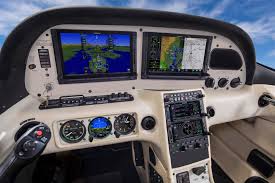
Cirrus SR22 Equipped with Dual G500 TXi Screens and Dual Garmin GTN 650Xi GPS Units
The cost for the panel? Two 10.6″ G500 TXi’s run about $16,000 apiece for the units, not including labor. $32,000 for a brand new panel isn’t terrible. Plus, the G500 TXi’s work with the DFC90 autopilot if the Cirrus is already equipped with it. If not, the Garmin GFC 500 autopilot is now approved for the Cirrus at a relatively low price of $7,000, including the servos.
Still have the original Garmin 430s in your Cirrus? Upgraded to the Avidyne IFD 540/440 stack? Put in dual GTN 650Xi’s? Put in a GTN 750Xi? All are compatible with the G500 TXi panel.
Want to upgrade everything? It does get kind of pricey at that point, but for just equipment, the cost for a complete panel conversion is somewhere in the area of $65,000 plus labor, still below what the R9 cost, but not cheap either. That would include 2 G500 TXi’s, 2 GTN 650Xi’s, a GFC 500 Autopilot, and all the engine monitoring equipment that the G500 TXi would need.
Cirrus SR22 Equipped with Dual G500 TXi Screens, a GTN 750Xi, and a GTN 650Xi
Thankfully, some new technology has finally come to the Generation 1-3 Cirrus. Oh, and by the way, your steam gauge Cirrus is fully upgradable as well.
For a long time, I was happy if an FBO had a radio where I could tune the ATIS or automated weather before getting into the plane. This would allow me to skip listening to the weather in the airplane with the engine running, giving me a quicker exit from the ramp while burning a little less fuel. I would also be able to brief my taxi route from the ramp since I would know which runway was in use before getting in the plane.
As we progress forward in technology, I’m constantly amazed at how much more planning I can do from the palm of my hand. Now, I can call a phone number and get the ATIS, AWOS, or ASOS, depending on the size of the airport; if you prefer reading a text version…well, there’s an app for that.
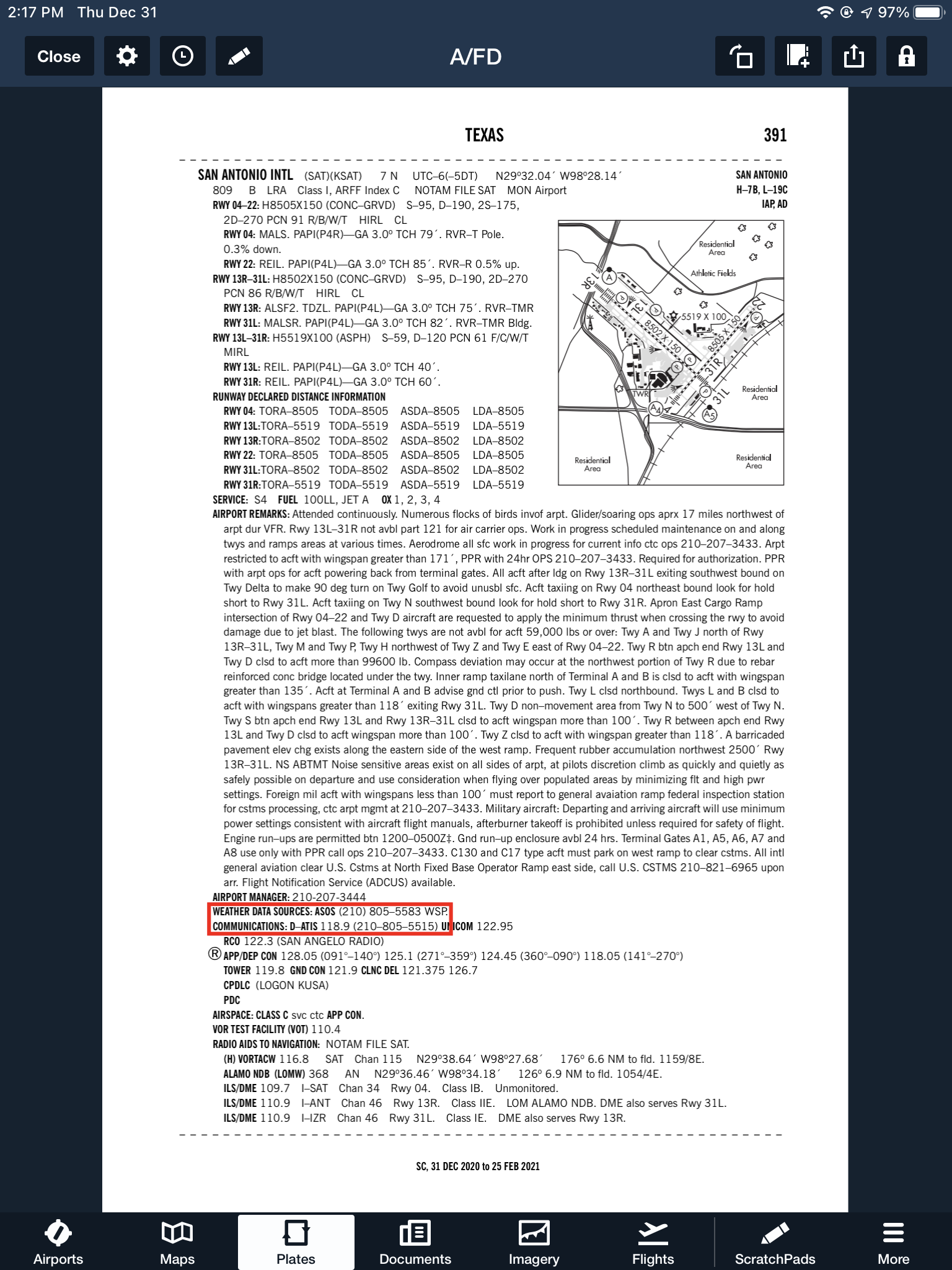
With this technology, it’s very important for pilots to be aware of what service they are utilizing when calling these numbers. Usually only a Class B or larger Class C airport will have a phone number specifically for ATIS as well as one for AWOS/ASOS. These are listed in the Airport/Facility Directory (AFD), as well as all flight planning apps (Foreflight, Garmin Pilot, Stratus Insight). More then one pilot has called the AWOS/ASOS number for an airport thinking they would receive the ATIS (because towered airports that have ATIS phone numbers often also have AWOS/ASOS phone numbers that are different). Since the pilot didn’t hear a code on the phone, that led to the false thinking that either the tower was closed or the pilot did not have the code (ie. Information Bravo) to give to ground control when calling for taxi instructions. The minute weather can be very useful for flight planning, but the ATIS must be received before contacting ATC at a towered airport.
Notice the red box just past halfway down the page. There is a phone number for the ASOS at KSAT and a separate phone number for the ATIS next to the frequency.
Sometimes, you may get a busy tone if someone else is on the line. Usually, waiting a few minutes and trying again will lead to success. Just like old school phone lines, only one call can go through at at time! If it’s a particularly stormy day, you may be fighting a number of pilots to get on the line. In this case, an app where you can read the ATIS may be particularly helpful (Yes, there actually is a dedicated ATIS App!).
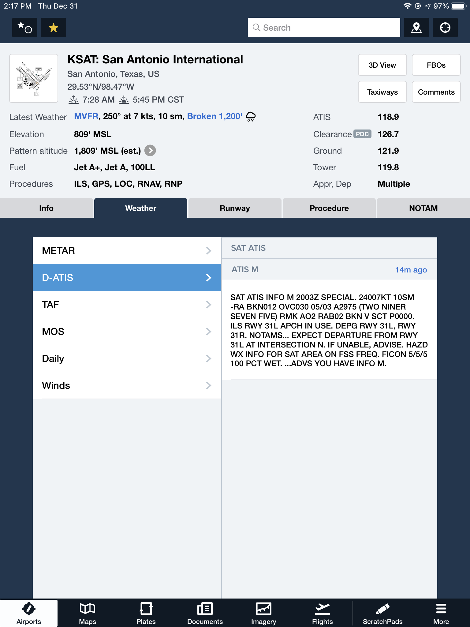
The ATIS app allows us lowly pilots without an Aircraft Communicating and Reporting System (ACARS) to access the Digital ATIS (D-ATIS ) at airports where ATIS is available. Only 76 airports in the US have D-ATIS, most of which are either Class B or busier Class C airports. Foreflight also provides D-ATIS textually at the same 76 airports, though it is only accessible depending on which subscription level you have with Foreflight (since I’m not a Garmin Pilot or Stratus Insight user, I’m not sure if either of them give D-ATIS reports).
ATIS App Symbol
With Foreflight’s D-ATIS, it does not get updated over ADS-B, only when your iPad or phone have an internet signal. When inbound to an airport with D-ATIS, the pilot has to listen to the radio frequency to get the current ATIS. Foreflight will display the last D-ATIS it received, but typically, it’s old. Check the time in the upper right hand corner.
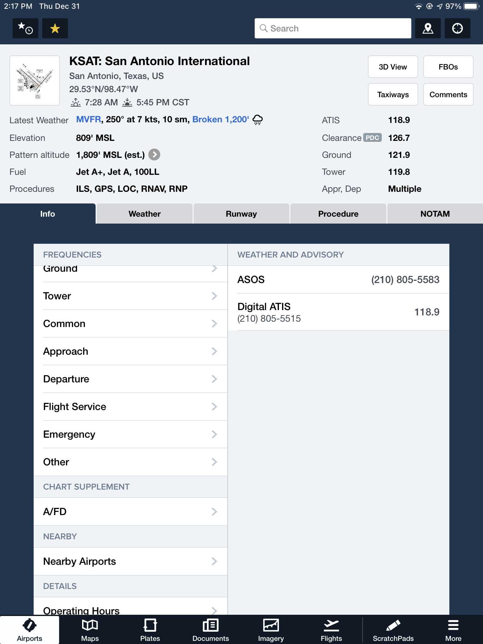
On the Airports page on Foreflight, tap Info, then tap Weather & Advisory and the phone numbers will display along with the ATIS frequency
On the Airports page, tab Weather, then tap D-ATIS, and the last received D-ATIS will display. Note the age of the D-ATIS in the upper right hand corner
Foreflight now offers Pre-Departure Clearance (PDC) at those same 76 airports. With either a pre-registered tail number or a Foreflight call sign (starting in FFL), once a pilot files an IFR flight plan, the D-ATIS and the IFR clearance in it’s entirety are texted to the phone number the pilot filed with. All that is left to do is call ground, state “I have information Romeo and my clearance, ready to taxi,” then away you go. Skipping listening to the ATIS and talking to Clearance Delivery saves a good 5-10 minutes at times, depending on how busy the airport is.
These days, there are many different avenues to get the current weather (and IFR clearances!). When calling on the phone, the key is to be aware, know which number you are calling and, if you are expecting to hear an ATIS message but instead hear the AWOS/ASOS, verify the Chart Supplement Guide and Notices to Airmen (NOTAMS) to check tower hours of operation before flying into the airspace.
Are you thinking of buying an iPad and going to a paperless cockpit? Have you just recently purchased an iPad and are unsure of how to use Foreflight to it’s fullest extent? Check out this free webinar on Monday, January 19th. Gary Reeves, a Master CFI from California, will be hosting the 90 minute seminar, which begins at 1800 Z. He will be able to point you in the right direction for what type of iPad to purchase, how to set up your Foreflight account, and the basics of using the App.
You can finally get rid of those paper charts, saving clutter in the cockpit. Just make sure you bring along a charger for those extended flight in case your battery dips low!
To sign up for this webinar, click here. There is no cost associated with the webinar.
16 Comments
Thank you! For this in depth answer to a problem I have been perplexed with… Just press the OBS button for the missed on an RNAV or the OBS and then the CDI for a VLOC approach. Simple as that… Thanx
I blew my IFR check ride because I hadn’t seen this article!! Now I know and am much better prepared for my retest….now if only my wallet was as prepared!
Good article, thanks. I know it’s several years later, but here are my two cents. The GNS480 (Apollo CNX-80) did it better by assuming the pilot would do a missed approach and having everything set for a missed. If the pilot lands, then so be it… nothing is lost.
But why force the pilot to push more buttons on their GPS when they have a bunch of more important stuff to do with the plane to go missed (power, flaps, gear, pitch, etc). Garmin got it wrong, imho. I’ve been flying the 480 for years and am using a simulator that has a 430. I much prefer the 480 for every aspect of flight.
Martha, you have a couple different options. If it is the exact same approach you just flew and you are getting vectors to final, all you have to do is press the PROC key, then highlight Activate Vectors to Final and press Enter. Then everything resets and the final approach course will be your active leg with your FAF as your active waypoint.
If you are flying another approach to the same airport, use PROC and Select Approach to select the new approach.
If you are flying an approach at another airport, the quickest way to set things up is press the Direct To key, dial in the new airport, then use PROC from there.
All of these options will take the GPS out of SUSP mode.
Hi Martha, it’s very simple. If you go missed on one approach and want to try the same approach again, just press the PROC key, then activate the approach again to go to the same IAF that you just flew the approach with. If you are going to get vectors, then use Activate Vectors to Final.
So on the 430/530waas can you just do the 1st 2 steps for the missed? Say climb 2000 then climbing right turn to 180 degrees. Then the gps will depict the radial or the other part to the hold and then give you the heading to fly?
One of my aircraft with a dual 430/530 setup actually won’t go in to suspend mode on a missed approach. Instead it just over fly’s the waypoint and then starts counting up whilst it then directs you to the next nearest waypoint… I assume it must be a setting issue but as yet I have been unable to work it out. Any ideas?
Hi Grant, I haven’t heard of that one before. The Flight Plan doesn’t go to the next leg (or the first fix on the missed approach)? That would be an avionics shop question.
On an LPV aprch when removing the hold, the Garmin 530 goes into suspend mode, also.Should the suspend mode be removed to fly the aprch? I know you could activate vectors to final but I am curious as to what happens if you leave it in suspend mode. Thanks all.
Hi Tony, I’m assuming this happens when you are on the wrong side of the IAF that the hold was drawn on? Meaning, the FAC is 180, but you are headed 360 and you haven’t passed abeam the IAF yet. IF that is the case, then once you go direct to the IAF that you deleted the hold from, the 530 will go out of suspend. If you are getting vectors, you are correct and can activate vectors to final, or could press OBS to unsuspend manually.
When flying a GPS approach and navigating directly to a way point on the approach ,How do I configure my Garmin 400 to hold at fix that say center wants me to hold At . For example, I’m flying into Sun Valley on The GPS 31 and center says “ fly direct to Presn” hold as published make one circuit then cleared for approach.
Hi Scott, I’m assuming a Garmin 400 is a Garmin 430 without the Nav/Com. I looked at the approach plate and PRESN is the Missed Approach point as well as one of the IAFs. If Center gives you the above instruction, you have to jump through a few hoops to get this to work. First, load the approach into the Garmin with PRESN as the transition. Then, when Center tells you to go direct to it, since the published hold is part of the Missed Approach, on your Flight Plan page, go down to the PRESN missed approach waypoint, press Direct To, and enter twice. This will cause the GPS to go into the hold. Then, on your inbound leg back to PRESN, go back up to the PRESN IAF in your GPS flight plan, highlight it, press Direct To, enter twice, and then it will cycle over to the approach.

 Garmin designed their software with this in mind. When an airplane crosses the missed approach point, the GPS will go into what’s called suspend mode (a SUSP annunciation appears above the OBS key). It will keep the missed approach point as the active waypoint because it assumes the pilot is going to land.






Thank you! For this in depth answer to a problem I have been perplexed with… Just press the OBS button for the missed on an RNAV or the OBS and then the CDI for a VLOC approach. Simple as that… Thanx
I blew my IFR check ride because I hadn’t seen this article!! Now I know and am much better prepared for my retest….now if only my wallet was as prepared!
Good article, thanks. I know it’s several years later, but here are my two cents. The GNS480 (Apollo CNX-80) did it better by assuming the pilot would do a missed approach and having everything set for a missed. If the pilot lands, then so be it… nothing is lost.
But why force the pilot to push more buttons on their GPS when they have a bunch of more important stuff to do with the plane to go missed (power, flaps, gear, pitch, etc). Garmin got it wrong, imho. I’ve been flying the 480 for years and am using a simulator that has a 430. I much prefer the 480 for every aspect of flight.
What if you don’t want to do the published miss but are getting vectors for another “try” – same ILS approach?
Martha, you have a couple different options. If it is the exact same approach you just flew and you are getting vectors to final, all you have to do is press the PROC key, then highlight Activate Vectors to Final and press Enter. Then everything resets and the final approach course will be your active leg with your FAF as your active waypoint.
If you are flying another approach to the same airport, use PROC and Select Approach to select the new approach.
If you are flying an approach at another airport, the quickest way to set things up is press the Direct To key, dial in the new airport, then use PROC from there.
All of these options will take the GPS out of SUSP mode.
Hi Martha, it’s very simple. If you go missed on one approach and want to try the same approach again, just press the PROC key, then activate the approach again to go to the same IAF that you just flew the approach with. If you are going to get vectors, then use Activate Vectors to Final.
So on the 430/530waas can you just do the 1st 2 steps for the missed? Say climb 2000 then climbing right turn to 180 degrees. Then the gps will depict the radial or the other part to the hold and then give you the heading to fly?
Yes, that is correct.
One of my aircraft with a dual 430/530 setup actually won’t go in to suspend mode on a missed approach. Instead it just over fly’s the waypoint and then starts counting up whilst it then directs you to the next nearest waypoint… I assume it must be a setting issue but as yet I have been unable to work it out. Any ideas?
Hi Grant, I haven’t heard of that one before. The Flight Plan doesn’t go to the next leg (or the first fix on the missed approach)? That would be an avionics shop question.
On an LPV aprch when removing the hold, the Garmin 530 goes into suspend mode, also.Should the suspend mode be removed to fly the aprch? I know you could activate vectors to final but I am curious as to what happens if you leave it in suspend mode. Thanks all.
Hi Tony, I’m assuming this happens when you are on the wrong side of the IAF that the hold was drawn on? Meaning, the FAC is 180, but you are headed 360 and you haven’t passed abeam the IAF yet. IF that is the case, then once you go direct to the IAF that you deleted the hold from, the 530 will go out of suspend. If you are getting vectors, you are correct and can activate vectors to final, or could press OBS to unsuspend manually.
When flying a GPS approach and navigating directly to a way point on the approach ,How do I configure my Garmin 400 to hold at fix that say center wants me to hold At . For example, I’m flying into Sun Valley on The GPS 31 and center says “ fly direct to Presn” hold as published make one circuit then cleared for approach.
Hi Scott, I’m assuming a Garmin 400 is a Garmin 430 without the Nav/Com. I looked at the approach plate and PRESN is the Missed Approach point as well as one of the IAFs. If Center gives you the above instruction, you have to jump through a few hoops to get this to work. First, load the approach into the Garmin with PRESN as the transition. Then, when Center tells you to go direct to it, since the published hold is part of the Missed Approach, on your Flight Plan page, go down to the PRESN missed approach waypoint, press Direct To, and enter twice. This will cause the GPS to go into the hold. Then, on your inbound leg back to PRESN, go back up to the PRESN IAF in your GPS flight plan, highlight it, press Direct To, enter twice, and then it will cycle over to the approach.
Great article! I found the explanation of Garmin 530/430 missed approaches easy to understand, thanks for breaking it down!